
Sign in
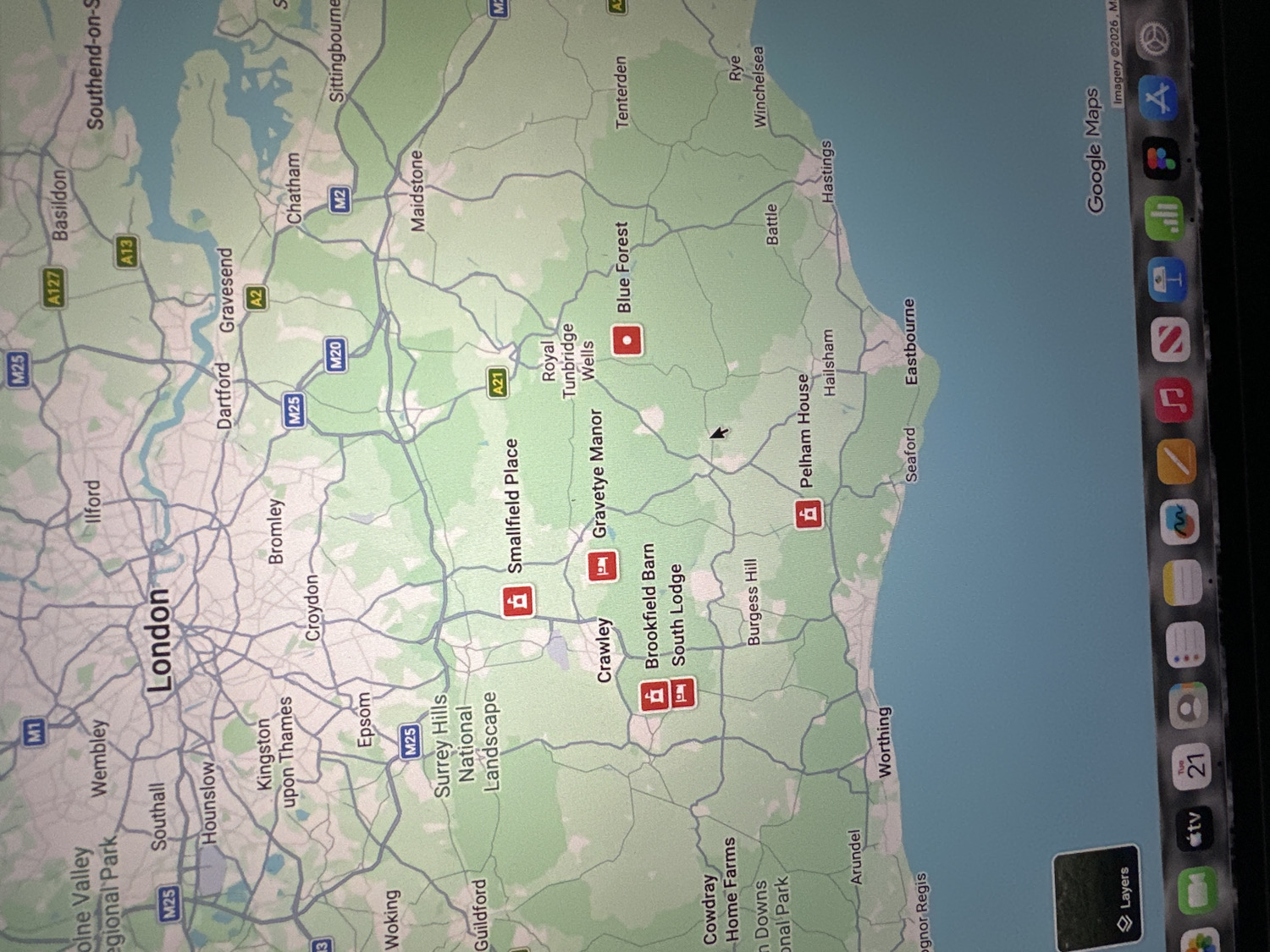
The media file displays a digital map of Southern England, likely a screenshot from a tablet or iPad, presented in a rotated portrait orientation. The map's central focus is London, surrounded by parts of Kent, Surrey, East Sussex, and West Sussex, with the English Channel coastline visible to the south.

The primary activity depicted is the viewing of geographical information through a mapping application. A small black arrow cursor is visible on the map.

Notable details include a comprehensive road network with major motorways and A-roads such as the M25, M20, M2, A2, A21, A13, and A127. Key urban centers and towns are labeled, including London, Maidstone, Chatham, Dartford, Bromley, Croydon, Epsom, Guildford, Woking, Worthing, Eastbourne, Hastings, and Royal Tunbridge Wells. Expansive green areas indicate rural landscapes like the "Surrey Hills National Landscape" and "Blue Forest." Several points of interest are marked with red icons, suggesting lodging or tourist attractions, including "Smallfield Place," "Gravetye Manor," "Brookfield Barn," "South Lodge," and "Pelham House."

Visible text includes "Google Maps" and "Imagery ©2026, M" at the top right. Numerous place names and road numbers are legible across the map. A sidebar on the right side of the screen shows various application icons, with partially visible text such as "Tue 21" next to a calendar icon and "tv" below it. Other recognizable app icons include Mail, Messages, Safari, Photos, and Music.
kittyorkatherine

Apr 21, 2026, 11:21 AM

Wealden, UK

Moment

Stake attention in this memory

untagged

The media file displays a digital map of Southern England, likely a screenshot from a tablet or iPad, presented in a rotated portrait orientation. The map's central focus is London, surrounded by parts of Kent, Surrey, East Sussex, and West Sussex, with the English Channel coastline visible to the south. The primary activity depicted is the viewing of geographical information through a mapping application. A small black arrow cursor is visible on the map. Notable details include a comprehensive road network with major motorways and A-roads such as the M25, M20, M2, A2, A21, A13, and A127. Key urban centers and towns are labeled, including London, Maidstone, Chatham, Dartford, Bromley, Croydon, Epsom, Guildford, Woking, Worthing, Eastbourne, Hastings, and Royal Tunbridge Wells. Expansive green areas indicate rural landscapes like the "Surrey Hills National Landscape" and "Blue Forest." Several points of interest are marked with red icons, suggesting lodging or tourist attractions, including "Smallfield Place," "Gravetye Manor," "Brookfield Barn," "South Lodge," and "Pelham House." Visible text includes "Google Maps" and "Imagery ©2026, M" at the top right. Numerous place names and road numbers are legible across the map. A sidebar on the right side of the screen shows various application icons, with partially visible text such as "Tue 21" next to a calendar icon and "tv" below it. Other recognizable app icons include Mail, Messages, Safari, Photos, and Music.

Symbol

EC8F8

Volume

9,916

Creator

+$0.05

Revenue

+$0.00

TVL

$4.80

1D
1W
1M
All

Loading AttnAds…

transactions
revenues
stakers
Earliest
Latest
Highest stake

1

@anyone

Staked 2mo ago

$4.85 USD

-$0.05 USD

-1%

More from this user

More from Wealden

kittyorkatherine

Apr 21, 2026, 11:21 AM

Wealden, UK

Licensed under Creative Commons Attribution 4.0 International License. You are free to share and adapt this content with proper attribution.