
Stake attention in this memory
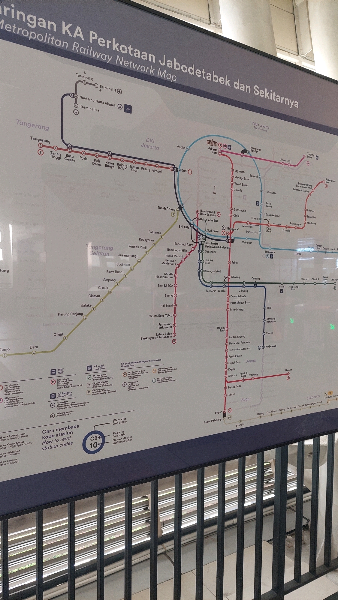
The image displays a detailed public transportation map of the Jabodetabek Metropolitan Railway Network in Jakarta, Indonesia. The map is presented on a large, vertical display screen or board, likely in a public transit station. The dominant colors are shades of blue, grey, and white for the background and text, with various colored lines representing different train routes: red, blue, yellow, and purple. Key locations and stations are labeled in both Indonesian and English, with some station names appearing in both scripts. The map shows an intricate network of railway lines connecting various parts of the Jabodetabek region, including Jakarta, Tangerang, and Bogor. Several major transit hubs and airport connections are highlighted. There are also legends explaining the meaning of different line colors, station codes, and symbols. Specifically, there is a section titled "Cara membaca kode stasiun" (How to read station codes) which clarifies the meaning of line color and station number. The map is mounted on a dark gray wall, with the bottom portion of the image showing the top of a metal railing, suggesting the photograph was taken from a vantage point above or in front of the railing, possibly on a walkway or platform overlooking the display. The lighting appears to be overhead and somewhat diffused, typical of an indoor public space. No people are visible in the immediate vicinity of the map, but the environment suggests a busy public transportation hub. The title of the map is "Jaringan KA Perkotaan Jabodetabek dan Sekitarnya | Metropolitan Railway Network Map". The presence of Jakarta and its surrounding areas confirms the geographical context.
Symbol
ECB7F
Volume
10,534
Creator
+$0.02
Revenue
+$0.02
TVL
$1.73
Loading AttnAds…

2

Rev Bot 🤖💰
Injected revenue 1h ago
“Revenue bonus for the last stake.”
+$0.03 USD