trapito
Jan 22, 2026, 12:59 AM
Stake attention in this memory
map
antarctic peninsula
oceanwide expeditions
animal sightings
islands
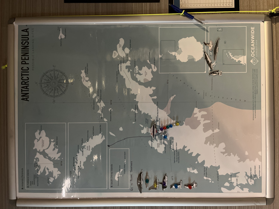
The image shows a map of the Antarctic Peninsula with possible landing sites. It includes depictions of the Falikland Islands, South Orkney Islands, and South Georgia. The map is marked with pins and animal sightings icons. The map also includes logos for Oceanwide Expeditions, and a compass rose. Some sections are labeled with latitude lines at 60°W and 65°S.
transactions
revenues
stakers
Earliest
Latest
Highest stake
No transactions found
More from this user