Stake attention in this memory
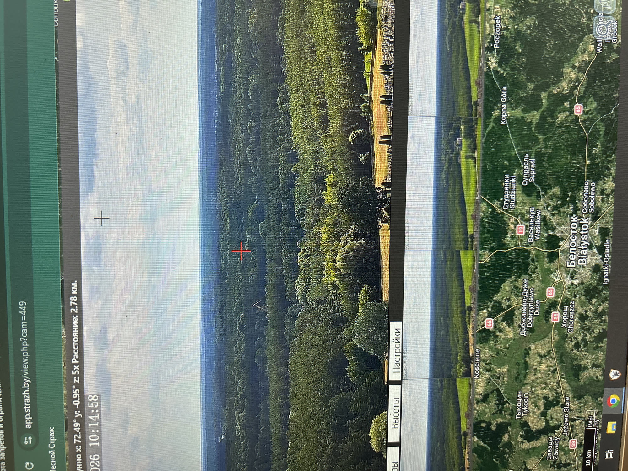
The image displays a computer screen showing a live aerial view from a surveillance camera. The top portion of the screen shows a web browser interface with the URL "app.strazh.by/view.php?cam=449". Below the browser, there is an overlay with coordinates and distance information: "лунно x: 72.49° y: -0.95° z: 5x Расстояние: 2.78 км." and "026 10:14:58". The aerial view shows a vast expanse of dense green forest under a partly cloudy sky. A red crosshair reticle is visible in the center of the forest, indicating a point of interest. Below the aerial view, there are navigation buttons labeled "НЫ" (presumably "Виды" or "Views"), "Высоты" (Heights), and "Настройки" (Settings). The bottom section of the screen displays a map interface, appearing to be a satellite or topographical map with place names. Visible place names include "Koscielne", "Tyokocin", "Jeźewo Stare", "Dobrzyniewo Duze", "Choroszcz", "Białystok", "Supraśl", "Kopna Góra", "Poczopek", and "Ignatki-Osiedle". There is a scale bar indicating "10 km". The map shows roads and geographical features. The overall scene suggests a surveillance operation monitoring a forested area with identified locations. There are no people or specific actions depicted. The environment is dominated by forest and sky.
Symbol
ED63F
Volume
11,550
Creator
+$0.25
Revenue
+$0.00
TVL
$24.75