Stake attention in this memory
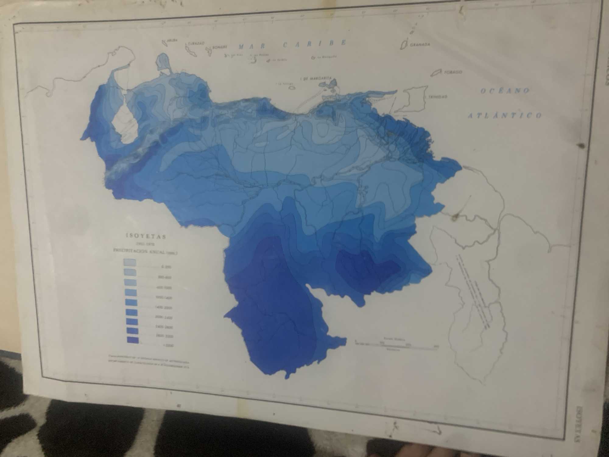
The image is a map showing isohyets, which are lines connecting points of equal rainfall, over a geographical area that appears to be a portion of Venezuela and surrounding islands. The map uses shades of blue to represent different rainfall amounts, with darker blues indicating higher rainfall. There is a legend on the left side of the map with blue bars and corresponding numerical values that represent rainfall in millimeters, ranging from less than 500 mm to over 2000 mm. Text on the map indicates "ISOTETAS" and "PRECIPITACION MEDIA ANUAL (mm)". Geographical features like coastlines, islands, and bodies of water such as the "MAR CARIBE" and "OCEANO ATLANTICO" are depicted. Names of some islands and locations like "GRANADA", "CURAZAO", and "BONAIRE" are visible. A scale is present at the bottom of the map, indicating distance. There are no people or specific buildings visible in the image. The city of La Tagua, Venezuela, is not explicitly identified or marked on this particular map.
Symbol
EDE74
Volume
11,550
Creator
+$0.14
Revenue
+$0.20
TVL
$11.58
2
Rev Bot 🤖💰
Injected revenue 6d ago
“Revenue bonus for the last stake.”
+$0.22 USD