
Sign in
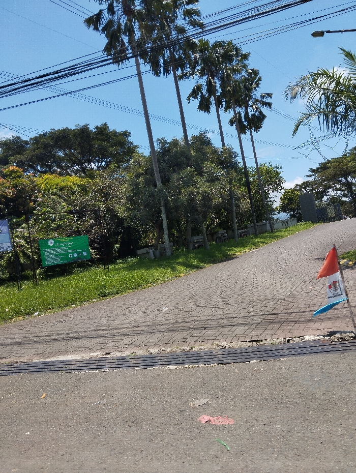
The image shows a paved road in Cangkuang, Indonesia, located at coordinates -7.056 latitude and 107.553 longitude. The road is made of brick pavers and slopes downwards towards the viewer. It leads into a grassy area with a green sign on the left side of the road, and a row of palm trees on the right side. There are power lines running overhead. At the bottom of the road, there is a black drain cover and a black asphalt surface. A red and white flag is standing on a pole in the grass on the right side of the road. There are no people visible in the image. The scene is under a clear blue sky with a few white clouds.
FM-ZEmon2

Mar 11, 2025, 5:22 AM

Cangkuang, Indonesia

Stake attention in this memory

tranquil
peaceful
serene
tropical
sunny

The image shows a paved road in Cangkuang, Indonesia, located at coordinates -7.056 latitude and 107.553 longitude. The road is made of brick pavers and slopes downwards towards the viewer. It leads into a grassy area with a green sign on the left side of the road, and a row of palm trees on the right side. There are power lines running overhead. At the bottom of the road, there is a black drain cover and a black asphalt surface. A red and white flag is standing on a pole in the grass on the right side of the road. There are no people visible in the image. The scene is under a clear blue sky with a few white clouds.

Loading AttnAds…

transactions
revenues
stakers
Earliest
Latest
Highest stake

No transactions found
More from this user

More from Cangkuang

FM-ZEmon2

Mar 11, 2025, 5:22 AM

Cangkuang, Indonesia

Licensed under Creative Commons Attribution 4.0 International License. You are free to share and adapt this content with proper attribution.