Stake attention in this memory
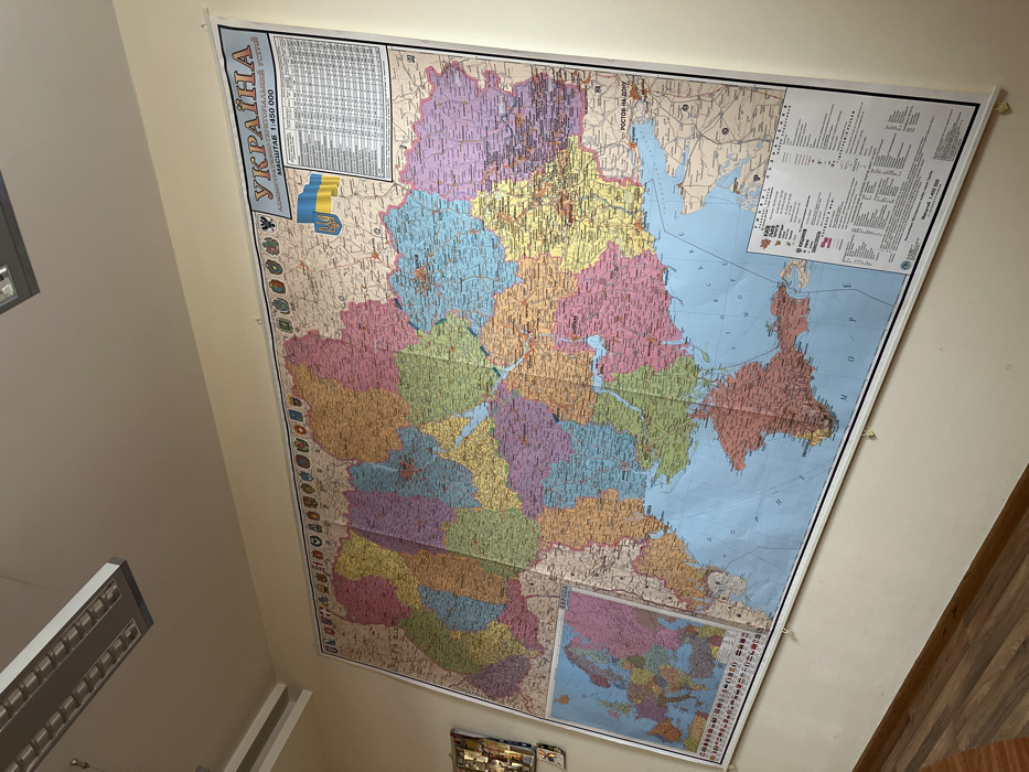
A large, colorful administrative map of Ukraine is prominently displayed on a light-colored indoor wall, likely in Kyiv. The map appears to be a physical wall-mounted educational or reference tool, tilted in the image due to the camera's angle. It depicts Ukraine divided into numerous administrative regions, each rendered in a distinct pastel color, with a dense network of cities, towns, and geographical features labeled in Cyrillic script. At the top left of the map, the title "УКРАЇНА" (UKRAINE) is clearly visible, followed by "АДМІНІСТРАТИВНО-ТЕРИТОРІАЛЬНИЙ УСТРІЙ" (ADMINISTRATIVE-TERRITORIAL STRUCTURE) and "МАСШТАБ 1:4 500 000" (SCALE 1:4,500,000). A representation of the blue and yellow Ukrainian flag is positioned beneath the main title. Adjacent to the title area and in the top right corner, there are detailed legends and tables, also in Cyrillic, providing symbols and possibly data related to the map's content, such as population centers or administrative classifications. The map includes geographical features like the Black Sea ("ЧОРНЕ МОРЕ") and the Sea of Azov ("АЗОВСЬКЕ МОРЕ"), which border Ukraine to the south and southeast. Parts of neighboring countries, such as Russia (e.g., "РОСТОВ-НА-ДОНУ" - Rostov-on-Don), are also depicted. A smaller inset map at the bottom right provides a broader geographical context, likely showing Ukraine's position within Europe or the world, complete with its own legend and details. The setting appears to be an indoor room, possibly an office, classroom, or study area, characterized by plain, light-colored walls and artificial lighting fixtures visible on the left side. A surface with a wooden pattern is visible on the right side of the frame. The map is secured to the wall at the top, possibly with clips or tape. No people or specific activities are visible, but the map itself is the central subject, serving as an informative display.
No transactions found