Stake attention in this memory
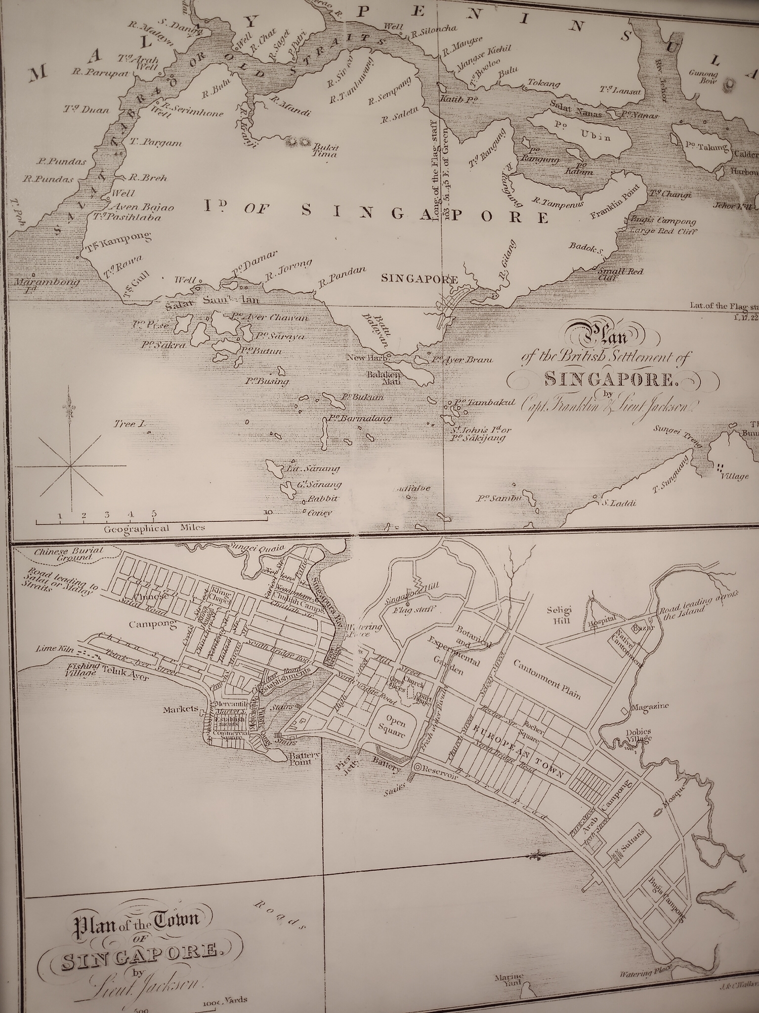
The image is a historical map titled "Plan of the British Settlement of Singapore," attributed to Capt. Franklin & Lieut. Jackson, along with a more detailed "Plan of the Town of Singapore" by Lieut. Jackson. The upper portion depicts the broader geographical area around Singapore, including islands and coastal features. Place names are labeled, such as "Po Ubin," "Salat Nanas," and "Franklin Point." The map includes directional indicators and a scale in geographical miles. Below is a detailed street map of Singapore town. Streets are labeled, including "South Bridge Road," "North Bridge Road," and "Chulia Street." Notable features are marked, such as "Markets," "Church," "Battery Point," "European Town," "Campong," "Mosque," "Magazine," "Cantonment Plain," "Botanical and Experimental Garden," and "Chinese Burial Ground." There is also a compass rose and a scale in yards.
Symbol
EE961
Volume
10
Creator
+$0.00
Revenue
+$0.00
TVL
$0.00
2
Rev Bot 🤖💰
Injected revenue 1mo ago
“Revenue bonus for the last stake.”
+$0.00 USD