Stake attention in this memory
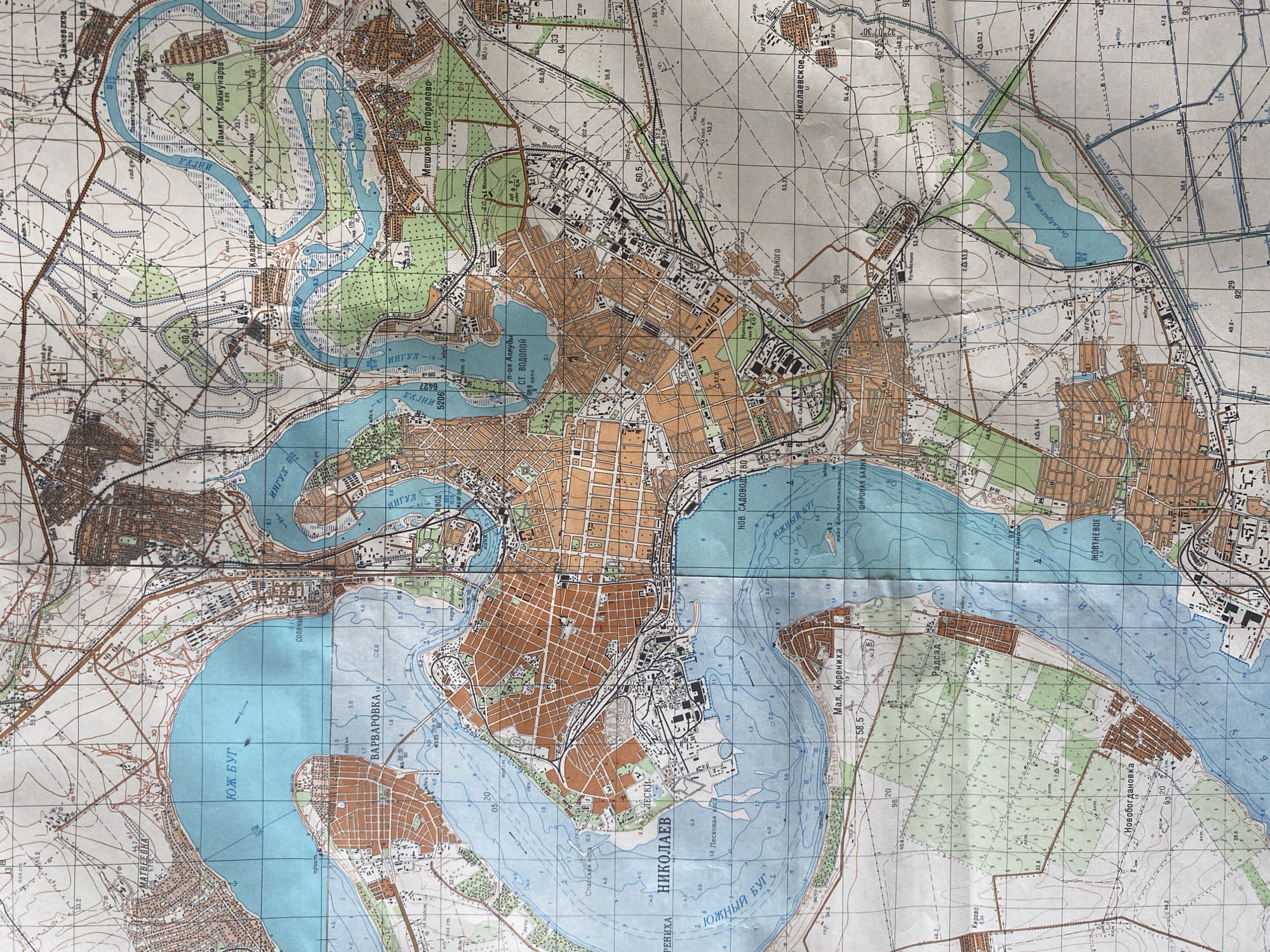
This is a scanned image of a detailed topographical map of Mykolaiv, Ukraine, and its surrounding areas. The map depicts the city's urban layout, with distinct areas marked by orange and brown hues representing buildings and residential zones. Numerous waterways are prominent, including the Inhul River, the Southern Bug River, and various bays and inlets such as "ЮЖНЫЙ БУГ" (Southern Bug), "ВАРВАРОВКА" (Varvarivka), and "ИНГУЛ" (Inhul). The map is filled with cartographic information, including contour lines indicating elevation, depth soundings in meters within the water bodies (e.g., 4.0, 1.8, 7.0), and numbered grid lines. Various place names are clearly labeled in Cyrillic script, such as "НИКОЛАЕВ" (Mykolaiv), "МАТВЕЕВКА" (Matviivka), "Мал. Корениха" (Mala Korenykha), "Мешково-Погорелово" (Meshkovo-Pogorelovo), and "Новобогдановка" (Novobogdanovka). Signs of infrastructure are visible, including railways, roads, and what appear to be industrial or port facilities along the riverbanks. Some areas are designated with specific names like "Парк Побед" (Victory Park) and "Память Коммунаров" (Memory of the Commune). The map also includes symbols that likely represent different types of terrain, vegetation, and structures. The overall impression is one of a meticulously detailed navigational and planning tool for the region.
Symbol
EEA70
Volume
3,648
Creator
+$0.02
Revenue
+$0.02
TVL
$1.44
2
Rev Bot 🤖💰
Injected revenue 1h ago
“Revenue bonus for the last stake.”
+$0.02 USD
More from Mykolaiv