
Sign in
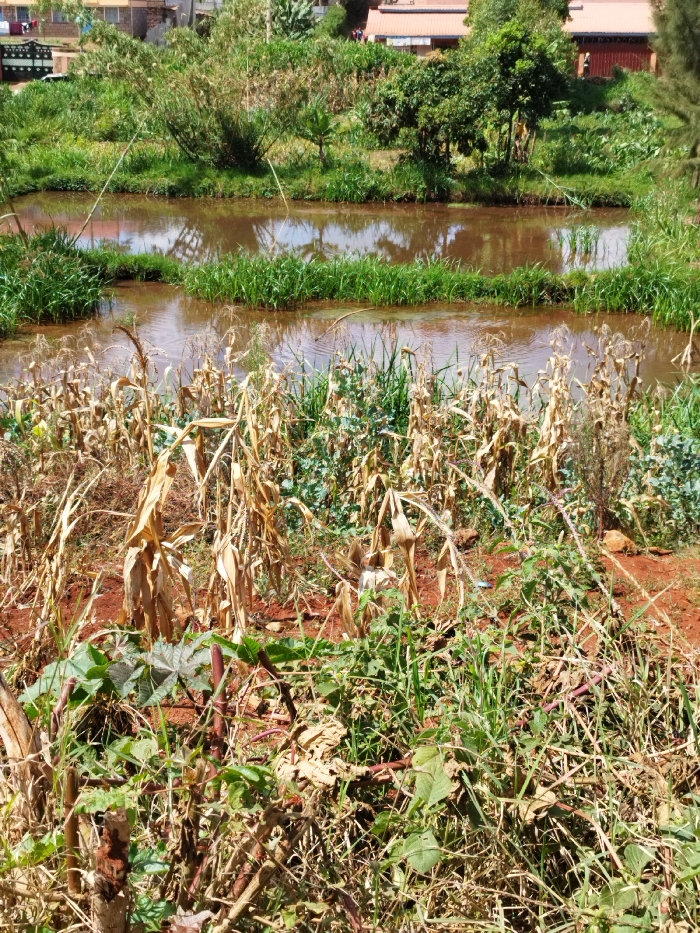
The image shows a dried-up cornfield in Nyeri, Kenya, located at the coordinates -0.43 latitude, 36.953 longitude. The field is situated near a shallow pond or reservoir filled with muddy brown water. The corn stalks are withered and brown, indicating a lack of water. The ground is red-brown, typical of the region's soil. There are patches of green vegetation amidst the dried corn stalks, suggesting that some plants are more resilient to the dry conditions. There are no people or animals present in the image. The scene is typical of a rural landscape in Kenya during the dry season.
Kanjes

Apr 4, 2025, 7:31 AM

Nyeri, Kenya

Stake attention in this memory

dry
dead
abandoned
sad
deprived

The image shows a dried-up cornfield in Nyeri, Kenya, located at the coordinates -0.43 latitude, 36.953 longitude. The field is situated near a shallow pond or reservoir filled with muddy brown water. The corn stalks are withered and brown, indicating a lack of water. The ground is red-brown, typical of the region's soil. There are patches of green vegetation amidst the dried corn stalks, suggesting that some plants are more resilient to the dry conditions. There are no people or animals present in the image. The scene is typical of a rural landscape in Kenya during the dry season.

Loading AttnAds…

transactions
revenues
stakers
Earliest
Latest
Highest stake

No transactions found

More from this user

More from Nyeri

Kanjes

Apr 4, 2025, 7:31 AM

Nyeri, Kenya

Licensed under Creative Commons Attribution 4.0 International License. You are free to share and adapt this content with proper attribution.