Stake attention in this memory
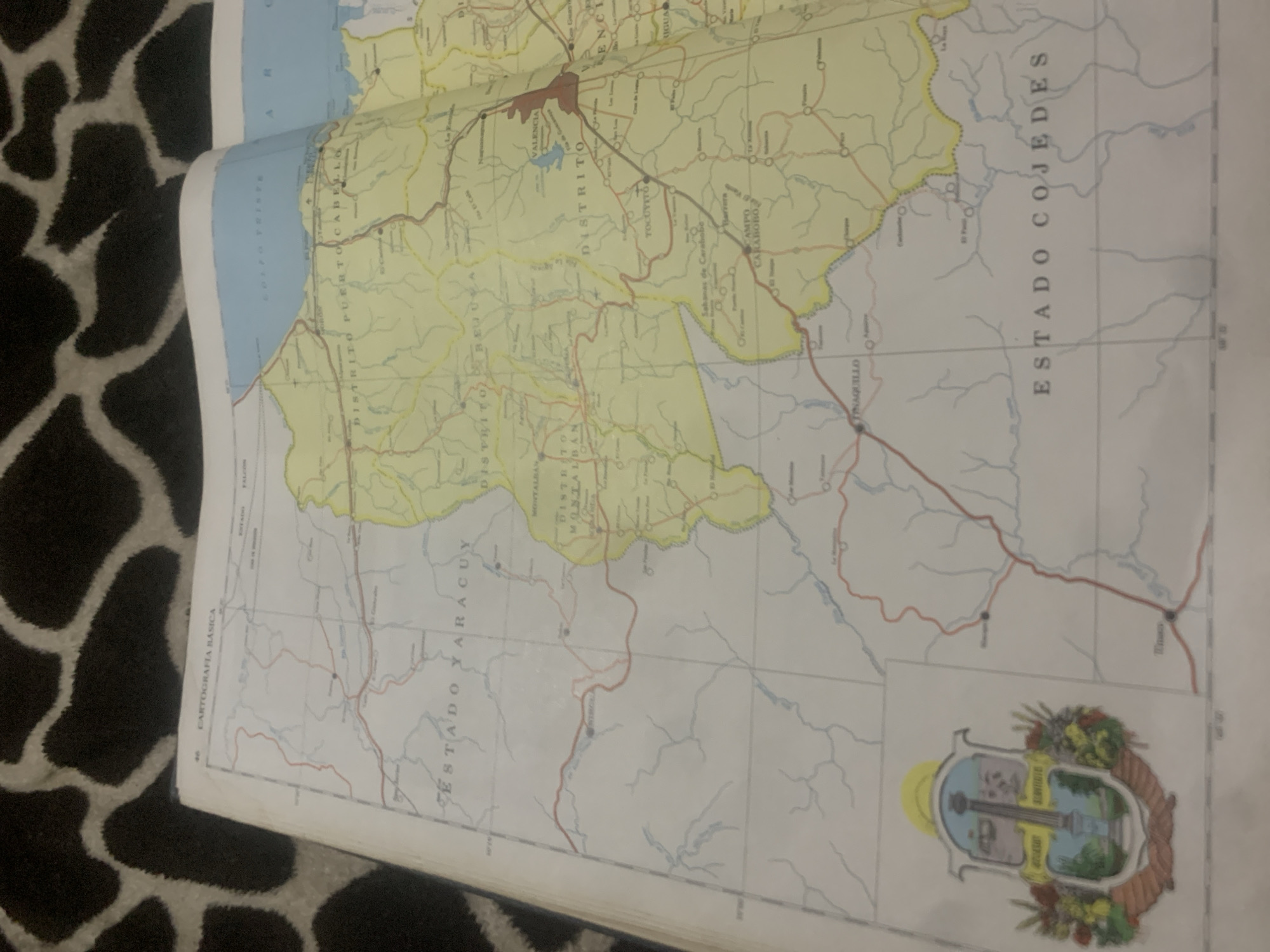
The image shows a close-up view of an opened map, with the left page featuring the coat of arms of Venezuela and the text "CARTOGRAFIA BASICA" at the top. The map displays various states and districts, including "ESTADO YARACUY," "DISTRITO PUERTO CABELLO," and "ESTADO COJEDES." Red lines indicate roads, and blue lines depict rivers. Several towns and cities are labeled, such as "VALENCIA," "TOCUYVITO," and "TINAQUILLO." The right page of the map shows a body of water labeled "GOLFO TRISTE" and part of "ESTADO FALCON" and "AR." There are no people or animals visible in the image. The map is laid on a dark patterned surface, possibly a cloth. The location of La Tagua, Venezuela, is not explicitly visible on this portion of the map.
Symbol
F0D06
Volume
0
Creator
+$0.14
Revenue
+$0.00
TVL
$0.00
2
Rev Bot 🤖💰
Injected revenue 6d ago
“Revenue bonus for the last stake.”
+$0.30 USD