Stake attention in this memory
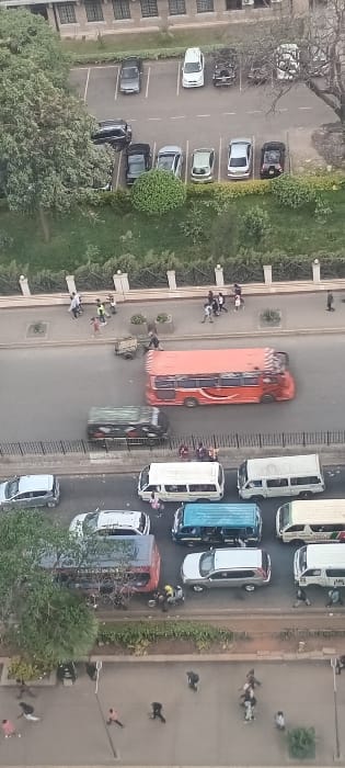
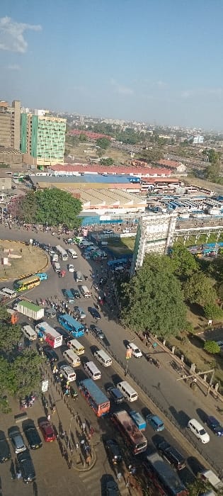
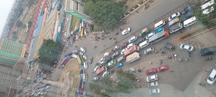
An aerial, high-angle view depicts a severely congested urban intersection in Nairobi, Kenya, specifically the Machakos Country Bus Station roundabout, also known as the intersection of Haile Selassie Avenue and Landhies Road. The scene is observed from a window, exhibiting a slight glare. The primary subject is heavy traffic and a high volume of pedestrians. Vehicles include numerous *matatus* (colorful minibuses), private cars (sedans, SUVs), and a few larger buses or trucks, predominantly stationary or moving slowly in multiple lanes converging on and departing from the roundabout. Parked vehicles line adjacent roads. Numerous pedestrians are visible on sidewalks, crosswalks, and along the road edges, suggesting busy commuter activity or market presence. Several individuals on motorcycles are interspersed within the traffic flow and on sidewalks. Environmental elements include: * A prominent, light-colored monument/obelisk centrally located within the roundabout. * Various multi-story buildings, including a tall, light-colored building with distinct green-paneled sections (identifiable as Afya Centre) dominating the upper left background. * Behind the Afya Centre, a complex of single-story and low-rise industrial-style buildings with blue and red roofs, likely market structures or warehouses, stretches into the mid-ground. * Areas of undeveloped land or construction sites are visible beyond these structures. * Trees are sparsely distributed along road edges and on grassy patches within the urban landscape. * Large advertising billboards are present near some background structures. The sky appears overcast or hazy.
Loading AttnAds…
No transactions found