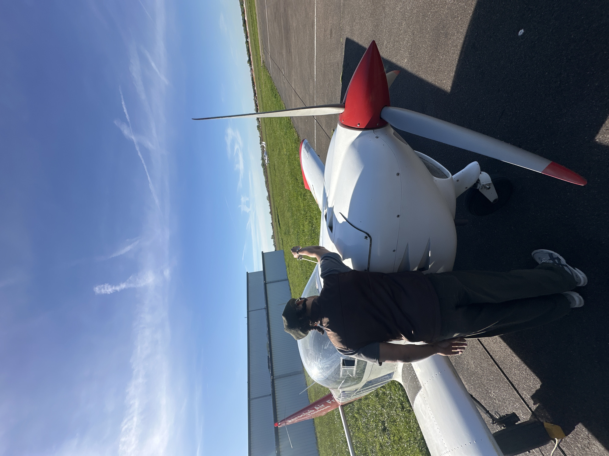
Stake attention in this memory
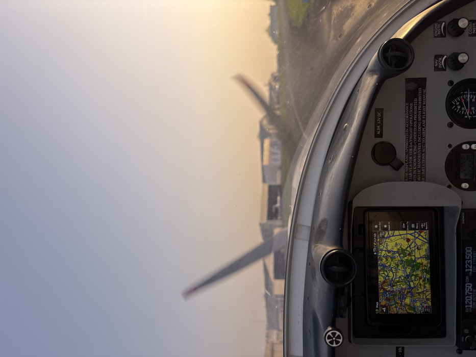
The image captures a first-person perspective from the cockpit of a light aircraft at Toussus-le-Noble Airport (LFPN), France, during a low sun angle period (likely sunrise or sunset). In the foreground, the top section of a grey and white aircraft dashboard is visible. Embedded in the dashboard is a digital navigation screen displaying a detailed, multi-colored geographical map, indicative of an urban or semi-urban area with roads, waterways, and possibly airspace information. The screen displays a timestamp of "17:53" and menu options like "Zoom Out," "Direct To," and "Return." Below this screen, a portion of radio frequency displays shows "120.750" and "123.500." To the right of the navigation screen, a rectangular plaque with text is affixed to the dashboard, reading in part: "R100 AIRPLANE. APPROVED IN ACCORDANCE FOR VFR DAY/NIGHT OPERATIONS. FLIGHTS IN KNOWN ICING CONDITIONS PROHIBITED. AEROBATIC MANOEUVRES INCLUDING SPINS PROHIBITED. REFER LIMITATIONS ACC. TO AIRPLANE FLIGHT MANUAL." Other cockpit elements include air vents, knobs labeled "NAV INSTR" and "ENGINE INSTR," and a "ALIM. 12V DC" input. Through the aircraft's windshield, the exterior environment is visible. The sky transitions from a pale blue in the upper left to a warm orange-yellow hue towards the right, suggesting either early morning or late afternoon. In the mid-ground, multiple hangars or airport buildings are present, slightly out of focus. To the left, the distinct T-tail empennage of another parked aircraft is partially visible. To the right, blurred propeller blades indicate an aircraft that is either taxiing or has its engine running. A paved taxiway or runway surface is visible leading into the distance on the right, bordered by green grass. No individuals are explicitly visible, but the active cockpit and surrounding aircraft suggest ongoing airport operations.
No transactions found