Stake attention in this memory
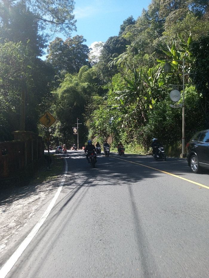
This image displays a two-way asphalt road cutting through a densely vegetated, sunny environment identified as Ka Thaung (Upper), Myanmar. The sky is clear blue with scattered white clouds. On the left, a low, weathered concrete wall parallels the road, partially obscured by shadows. Above it, a yellow diamond-shaped sign with a black squiggly arrow indicates a winding road. Further along the left, a street light pole features a circular, ornate sign. The right side of the road is bordered by a steep, lush hillside with dense green trees and tropical plants. Another street light pole on the right supports a circular sign with Arabic script and 'Al Rahman' written below. The road features a solid yellow centerline and a white fog line on the right shoulder. Approximately seven motorcycles, with most riders wearing helmets, are visible on the road, predominantly traveling away from the camera. A dark-colored car, consistent with an SUV, is partially visible on the far right, moving in the opposing lane. Distinct shadows from unseen overhead structures and foliage are cast across the road surface.
Symbol
F4E5B
Volume
1,038
Creator
+$0.00
Revenue
+$0.00
TVL
$0.14