Sign in
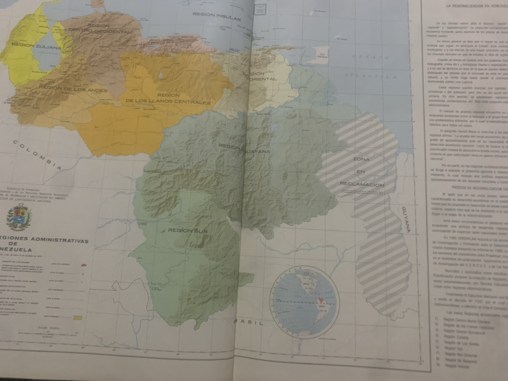
This media file is a photograph of a map of Venezuela, likely displayed in a public or educational setting. The map itself is a key object, illustrating the administrative regions of Venezuela. The subjects are the map and the surrounding text, which provides context and information about regionalization in Venezuela.

The activity taking place is the presentation or examination of this map, which details various regions like "REGION ZULIANA," "REGION DE LOS ANDES," "REGION INSULAR," and "REGION ORIENTAL," among others. Textual elements on the map and accompanying the map discuss the concept of regionalization in Venezuela, its historical context, and the process of implementing these regional divisions. The text also refers to government bodies such as "Ministerio del Ambiente y de los Recursos Naturales Renovables" and "Comisión de Cartografía Nacional."

Notable details include the prominent labeling of geographical features and administrative areas. The map shows a portion of Colombia to the west and Brazil to the south, indicating its geographical scope. There are also labels like "OCEANO ATLANTICO" and "ZONA EN RECLAMACION," hinting at the political and geographical landscape of the region. The image is well-lit, suggesting an indoor environment, possibly a classroom, library, or government office. There are no people visible in the photograph. The overall tone is informative and academic.
bombolico

Jun 25, 2026, 2:44 PM

La Tagua, Venezuela

BLOCKED

Stake attention in this memory

analytical
nostalgic
educational
formal
objective

This media file is a photograph of a map of Venezuela, likely displayed in a public or educational setting. The map itself is a key object, illustrating the administrative regions of Venezuela. The subjects are the map and the surrounding text, which provides context and information about regionalization in Venezuela. The activity taking place is the presentation or examination of this map, which details various regions like "REGION ZULIANA," "REGION DE LOS ANDES," "REGION INSULAR," and "REGION ORIENTAL," among others. Textual elements on the map and accompanying the map discuss the concept of regionalization in Venezuela, its historical context, and the process of implementing these regional divisions. The text also refers to government bodies such as "Ministerio del Ambiente y de los Recursos Naturales Renovables" and "Comisión de Cartografía Nacional." Notable details include the prominent labeling of geographical features and administrative areas. The map shows a portion of Colombia to the west and Brazil to the south, indicating its geographical scope. There are also labels like "OCEANO ATLANTICO" and "ZONA EN RECLAMACION," hinting at the political and geographical landscape of the region. The image is well-lit, suggesting an indoor environment, possibly a classroom, library, or government office. There are no people visible in the photograph. The overall tone is informative and academic.

Symbol

F5860

Volume

0

Creator

+$0.09

Revenue

+$0.00

TVL

$0.00

1D
1W
1M
All

Loading AttnAds…

transactions
revenues
stakers
Earliest
Latest
Highest stake

1

Ramón

Staked 11d ago
Redeemed 9d ago

$7.22 USD

+$0.04 USD

Fee: $0.07 (1%)

+0.5%

2

Rev Bot 🤖💰

Injected revenue 10d ago

Revenue bonus for the last stake.

+$0.20 USD

More from this user

More from La Tagua

bombolico

Jun 25, 2026, 2:44 PM

La Tagua, Venezuela

Licensed under Creative Commons Attribution 4.0 International License. You are free to share and adapt this content with proper attribution.





