
Stake attention in this memory
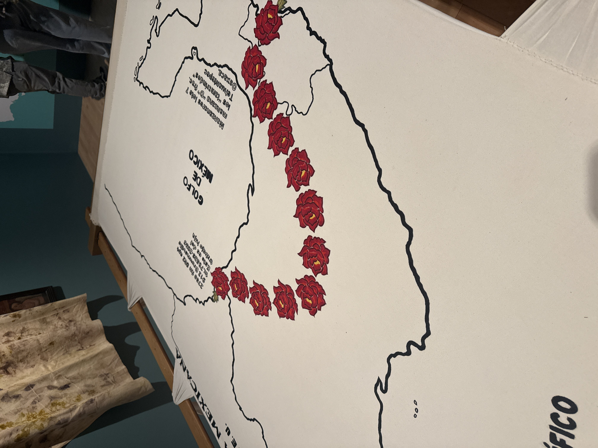
The image depicts a large map, likely printed on fabric, showing the Gulf of Mexico and a portion of Mexico. The map has black outlines of the coastlines and key geographical features. Several red roses are placed along the isthmus of Tehuantepec in Oaxaca. Text in Spanish appears on the map, including "GOLFO DE MEXICO," "MEXICANA E. U.," and "PACIFICO." There is also contact information: "2780 Ym 002 912 Brommavaille 14.78528-2285 Esta es del wabajo hija." And "Manzanares lote 7 manzana 'D' frac. los 'tamarindos' Tehuantepec Oaxaca." The map is propped up on a wooden frame. To the left, out of focus, are other items, possibly garments or textiles. The context suggests that the map is part of an exhibition or display. The exact location within Puebla, Mexico, is not discernible from the image itself.
Loading AttnAds…
No transactions found