
Stake attention in this memory
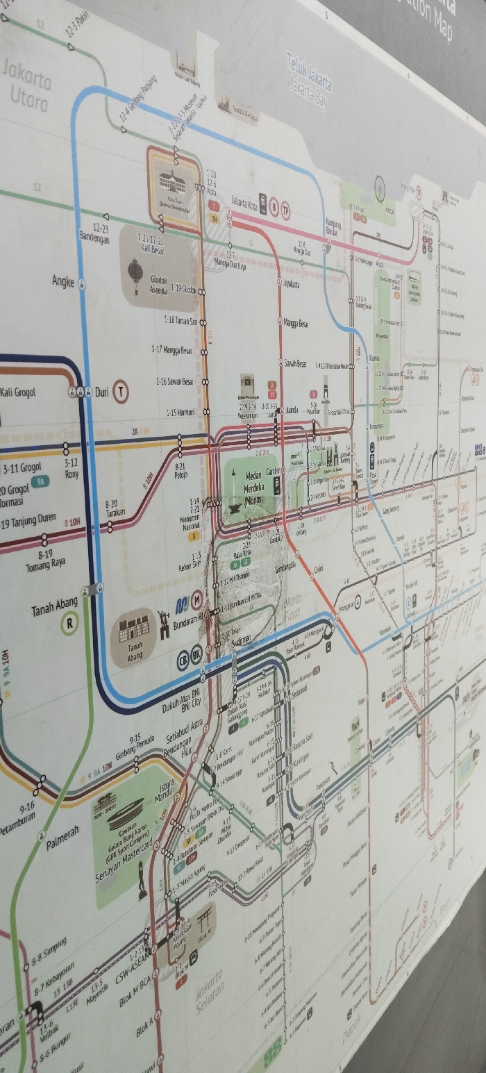
The image displays a photograph of a comprehensive transit map for Jakarta, Indonesia, likely mounted on a wall or information board in a public space. The map is viewed from a slightly angled perspective, with the bottom left appearing closer than the top right, leading to some distortion. Glare is visible across the surface, particularly in the upper right and central-right portions, obscuring some details. The map illustrates various public transportation routes, primarily characterized by distinct colored lines representing different services or corridors. Circular and triangular markers indicate stations along these routes. Key areas and landmarks in Jakarta are clearly labeled. **Visible Text and Locations:** * **Regions:** "Jakarta Utara" (North Jakarta) is prominent in the upper left. "Teluk Jakarta Jakarta Bay" is seen in the upper right. "Jakarta Pusat" (Central Jakarta) is in the central part, and "Jakarta Selatan" (South Jakarta) is towards the bottom right. "Depok" is partially visible at the bottom right. * **Major Stations/Interchanges:** "Jakarta Kota", "Glodok Asemka", "Harmoni", "Medan Merdeka (Monas)", "Bundaran HI", "Tanah Abang", "Dukuh Atas BNI BNI City", "Istora Mandiri", and "Blok M" are clearly visible. * **Route Numbers/Names:** Numerous lines are identified by numbers, often with suffixes (e.g., 1, 2, 3, 4, 5, 6, 8, 9, 9A, 10H, 12, 13, 13B, L13E). Specific station names like "12-3 Pakin", "12-4 Gedong Panjang", "1-2/1-2/1-5 Museum Sejarah Jakarta - Soaries", "1-19 Glodok", "1-18 Taman Sari", "1-17 Mangga Besar", "1-16 Sawah Besar", "1-15 Harmoni", "8-21 Petojo", "8-20 Tarakan", "3-11 Grogol", "3-12 Roxy", "8-19 Tomang Raya", "2-19/2-14 Juanda", "5-4/1-2 Kebon Sirih", "6-24 Dukuh Atas", "4-15 Karet", "9-14 Semanggi", and others are scattered across the map. * **Transportation Modes/Interchanges:** Symbols like 'M' (likely for MRT), 'R' (Rail/Commuter Line), 'T' (Train), 'B' (Bus), 'TP' (TransPatriot), 'CB' (Commuter Line), and 'BK' (KAI Bandara) are present at various interchange stations, indicating connections between different transit systems. * **Landmarks:** Small iconographic representations of landmarks include a mosque (near Sunda Kelapa), a building (Museum Sejarah Jakarta), a lantern (Glodok Asemka), the Monas monument (Medan Merdeka Monas), a traditional building (Tanah Abang), a fountain (Bundaran HI), and a stadium (Kawasan Gelora Bung Karno (GBR Sport Complex) Senayan Mastercard). **Visual Characteristics:** * The map uses a palette of bright colors for different lines, including blue, red, brown, green, and orange. * Station markers are generally small circles or triangles, sometimes enclosed in larger symbols for interchange points. * The background of the map is a light, off-white color. * Due to the angle and lighting, parts of the map exhibit reflective glare, making some station names and route details difficult to read clearly. There are also visible smudges and minor wear on the map's surface, particularly in the central "Jakarta Pusat" area. * The overall impression is that of a functional, user-friendly transit guide designed for public display.
Loading AttnAds…
No transactions found