Sign in
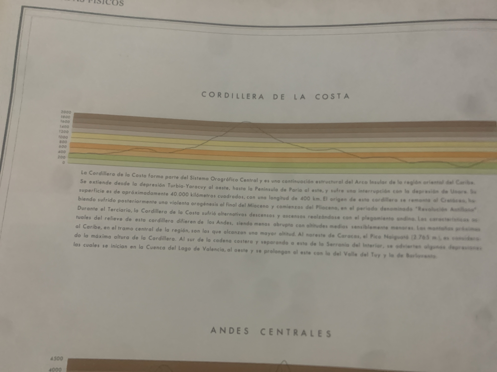
This is a geological cross-section depicting the "Cordillera de la Costa" in Venezuela, likely a page from an atlas or textbook. The image features a stylized topographical profile with colored bands representing different altitudes, ranging from 0 to 2000 meters. A line graph overlaid on this profile illustrates the elevation of the mountain range.

Below the graphic, descriptive text in Spanish provides information about the Cordillera de la Costa, its geological origin, extension, and characteristics. Key details include its formation from the Orinoco Orographic System, its extension from the Turbio-Yaracuy depression to the Paria Peninsula, its area of approximately 40,000 square kilometers, and a length of 400 kilometers. The text also mentions its geological period of origin, the "Antillean Revolution," and its Tertiary geological history with alternating descents and ascents. It contrasts the Cordillera de la Costa with the Andes, noting its less abrupt nature and lower average altitudes, with the exception of the Pico Naiguará at 2765 meters being the highest point. The text also mentions depressions to the south, including the Valencia Lake Basin and the Tuy Valley.

In the lower portion of the image, a section labeled "ANDES CENTRALES" suggests a comparison or continuation of geographical features, with a corresponding altitude scale from 4000 to 4500 meters, indicating the presence of even higher mountains. The overall impression is of a factual, educational document presenting geographical and geological data. There are no people or specific weather conditions depicted, and the scene is an abstract representation of topography.
bombolico

Jun 25, 2026, 2:04 PM

La Tagua, Venezuela

Moment

Stake attention in this memory

analytical
educational
serious
formal
informative

This is a geological cross-section depicting the "Cordillera de la Costa" in Venezuela, likely a page from an atlas or textbook. The image features a stylized topographical profile with colored bands representing different altitudes, ranging from 0 to 2000 meters. A line graph overlaid on this profile illustrates the elevation of the mountain range. Below the graphic, descriptive text in Spanish provides information about the Cordillera de la Costa, its geological origin, extension, and characteristics. Key details include its formation from the Orinoco Orographic System, its extension from the Turbio-Yaracuy depression to the Paria Peninsula, its area of approximately 40,000 square kilometers, and a length of 400 kilometers. The text also mentions its geological period of origin, the "Antillean Revolution," and its Tertiary geological history with alternating descents and ascents. It contrasts the Cordillera de la Costa with the Andes, noting its less abrupt nature and lower average altitudes, with the exception of the Pico Naiguará at 2765 meters being the highest point. The text also mentions depressions to the south, including the Valencia Lake Basin and the Tuy Valley. In the lower portion of the image, a section labeled "ANDES CENTRALES" suggests a comparison or continuation of geographical features, with a corresponding altitude scale from 4000 to 4500 meters, indicating the presence of even higher mountains. The overall impression is of a factual, educational document presenting geographical and geological data. There are no people or specific weather conditions depicted, and the scene is an abstract representation of topography.

Symbol

F7D75

Volume

0

Creator

+$0.08

Revenue

+$0.00

TVL

$0.00

1D
1W
1M
All

Loading AttnAds…

transactions
revenues
stakers
Earliest
Latest
Highest stake

1

Ramón

Staked 12d ago
Redeemed 11d ago

$6.26 USD

+$0.03 USD

Fee: $0.06 (1%)

+0.4%

2

Rev Bot 🤖💰

Injected revenue 12d ago

Revenue bonus for the last stake.

+$0.17 USD

More from this user

More from La Tagua

bombolico

Jun 25, 2026, 2:04 PM

La Tagua, Venezuela

Licensed under Creative Commons Attribution 4.0 International License. You are free to share and adapt this content with proper attribution.





