
Sign in
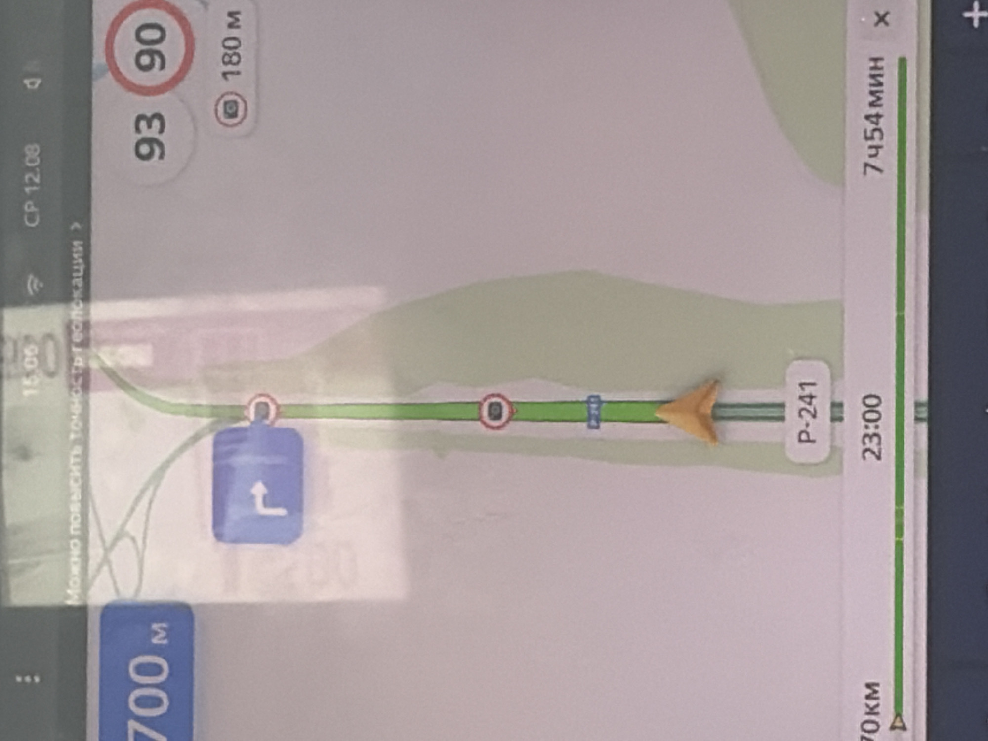
The image shows a screenshot from a car navigation system, likely displaying a map of Vershiny, Russia. On the screen, there is a route highlighted in green, indicating the path to be followed. Several icons and text overlays provide information about the navigation.

At the top of the screen, the time "CP 12.08" is visible, along with a signal strength indicator. Below this, there is a message in Russian: "Можно повысить точность геолокации" which translates to "Can improve geolocation accuracy."

To the left of the screen, "700m" is displayed, indicating the distance to a point or turn. A blue sign with a white arrow indicating a turn to the right is also visible. Further down the route, a circular sign with a red border and a number "90" inside indicates a speed limit of 90. Next to it, "93" is displayed, likely the current speed. A camera icon with "180m" suggests a speed camera located 180 meters ahead.

Along the bottom of the screen, "70км" (70 km) and "23:00" are displayed, possibly representing distance traveled or a destination. To the right, "7ч54мин" (7 hours 54 minutes) indicates the estimated time of arrival or remaining travel time. An "x" icon is present, which typically signifies closing or dismissing the information. A yellow directional arrow points upwards on the map, indicating the current direction of travel. The road number "P-241" is also visible.

The environment appears to be a road with some greenery surrounding it, suggesting a rural or suburban setting. The overall presentation is typical of a GPS navigation interface on a digital display.
yuliankaaa

Aug 12, 2026, 10:07 AM

Vershiny, Russia

Stake attention in this memory

navigation
driving
planning
road
information

The image shows a screenshot from a car navigation system, likely displaying a map of Vershiny, Russia. On the screen, there is a route highlighted in green, indicating the path to be followed. Several icons and text overlays provide information about the navigation. At the top of the screen, the time "CP 12.08" is visible, along with a signal strength indicator. Below this, there is a message in Russian: "Можно повысить точность геолокации" which translates to "Can improve geolocation accuracy." To the left of the screen, "700m" is displayed, indicating the distance to a point or turn. A blue sign with a white arrow indicating a turn to the right is also visible. Further down the route, a circular sign with a red border and a number "90" inside indicates a speed limit of 90. Next to it, "93" is displayed, likely the current speed. A camera icon with "180m" suggests a speed camera located 180 meters ahead. Along the bottom of the screen, "70км" (70 km) and "23:00" are displayed, possibly representing distance traveled or a destination. To the right, "7ч54мин" (7 hours 54 minutes) indicates the estimated time of arrival or remaining travel time. An "x" icon is present, which typically signifies closing or dismissing the information. A yellow directional arrow points upwards on the map, indicating the current direction of travel. The road number "P-241" is also visible. The environment appears to be a road with some greenery surrounding it, suggesting a rural or suburban setting. The overall presentation is typical of a GPS navigation interface on a digital display.

Loading AttnAds…

transactions
revenues
stakers
Earliest
Latest
Highest stake

No transactions found

More from this user

More from Vershiny
MemoryMemory
yuliankaaa

Aug 12, 2026, 10:07 AM

Vershiny, Russia

Licensed under Creative Commons Attribution 4.0 International License. You are free to share and adapt this content with proper attribution.