
Sign in
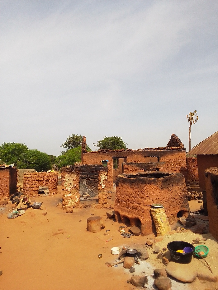
The image shows the aftermath of a fire in a village in Kwal, Nigeria, at coordinates 9.803 latitude and 8.646 longitude. The scene is a ruined mud-brick structure with charred walls and a collapsed roof. The surrounding ground is covered in red sand, and the remnants of burnt debris are scattered about.  Several cooking pots and utensils are visible, as well as a sack of grain and a plastic bucket. There are no people visible in the image. The sky is a light blue with some white clouds.  A single palm tree stands in the background.
FM-deXTS2

Apr 19, 2025, 8:58 AM

Kwal, Nigeria

Stake attention in this memory

ruined
destroyed
desolate
poverty
sadness

The image shows the aftermath of a fire in a village in Kwal, Nigeria, at coordinates 9.803 latitude and 8.646 longitude. The scene is a ruined mud-brick structure with charred walls and a collapsed roof. The surrounding ground is covered in red sand, and the remnants of burnt debris are scattered about. Several cooking pots and utensils are visible, as well as a sack of grain and a plastic bucket. There are no people visible in the image. The sky is a light blue with some white clouds. A single palm tree stands in the background.

Loading AttnAds…

transactions
revenues
stakers
Earliest
Latest
Highest stake

No transactions found
More from this user

More from Kwal

FM-deXTS2

Apr 19, 2025, 8:58 AM

Kwal, Nigeria

Licensed under Creative Commons Attribution 4.0 International License. You are free to share and adapt this content with proper attribution.