Stake attention in this memory
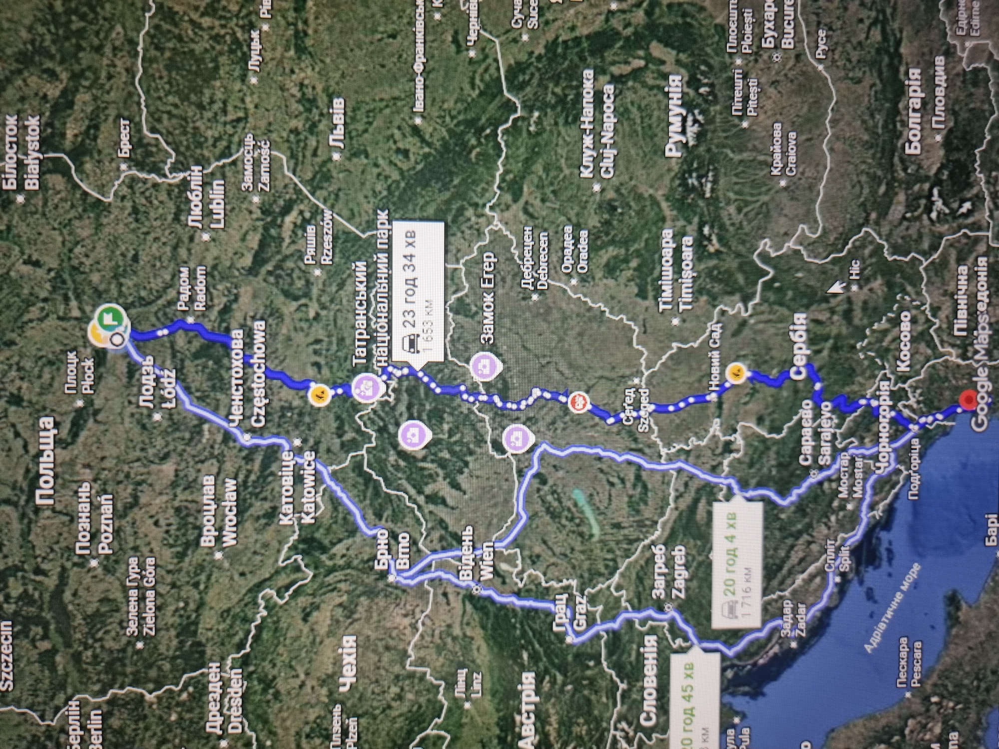
This is a screenshot of a navigation application, likely Google Maps, displaying a route across Eastern Europe. The route starts in Szczecin, Poland, and proceeds eastward through various Polish cities including Plock, Lodz, Radom, Lublin, and Chelmno. It then crosses into Ukraine, passing through Lviv, and continues into Romania, with a stop in Cluj-Napoca. From Romania, the route moves south into Serbia, then through Croatia, with stops in Zagreb and Split, and finally appears to end in or near Italy, with Pescara visible. Several cities are clearly labeled in both Polish and English, such as Bialystok, Brest, Zamosc, Katowice, Wroclaw, Rzeszow, and Timisoara. Other labeled cities include Vienna (Austria), Graz (Austria), Sarajevo (Bosnia and Herzegovina), and Mostar (Bosnia and Herzegovina). Some segments of the route are marked with estimated travel times and distances. For example, one segment shows "23 год 34 хв" (23 hours 34 minutes) for a distance of "1 653 км" (1,653 km). Another segment indicates "20 год 45 хв" (20 hours 45 minutes) and "20 год 4 хв" (20 hours 4 minutes) with distances of "1 716 км" (1,716 km). The map's satellite view shows a green and brown landscape, indicating diverse terrain with forests and mountains, particularly in the southern portions of the route in the Balkans. There are no people or specific objects visible beyond the map interface itself and the route markers, which are represented by circular icons. The image quality is somewhat grainy, suggesting it's a photograph of a screen. The lighting appears to be from overhead, typical of indoor environments. The overall impression is a detailed logistical plan for a long-distance road trip.
No transactions found