Stake attention in this memory
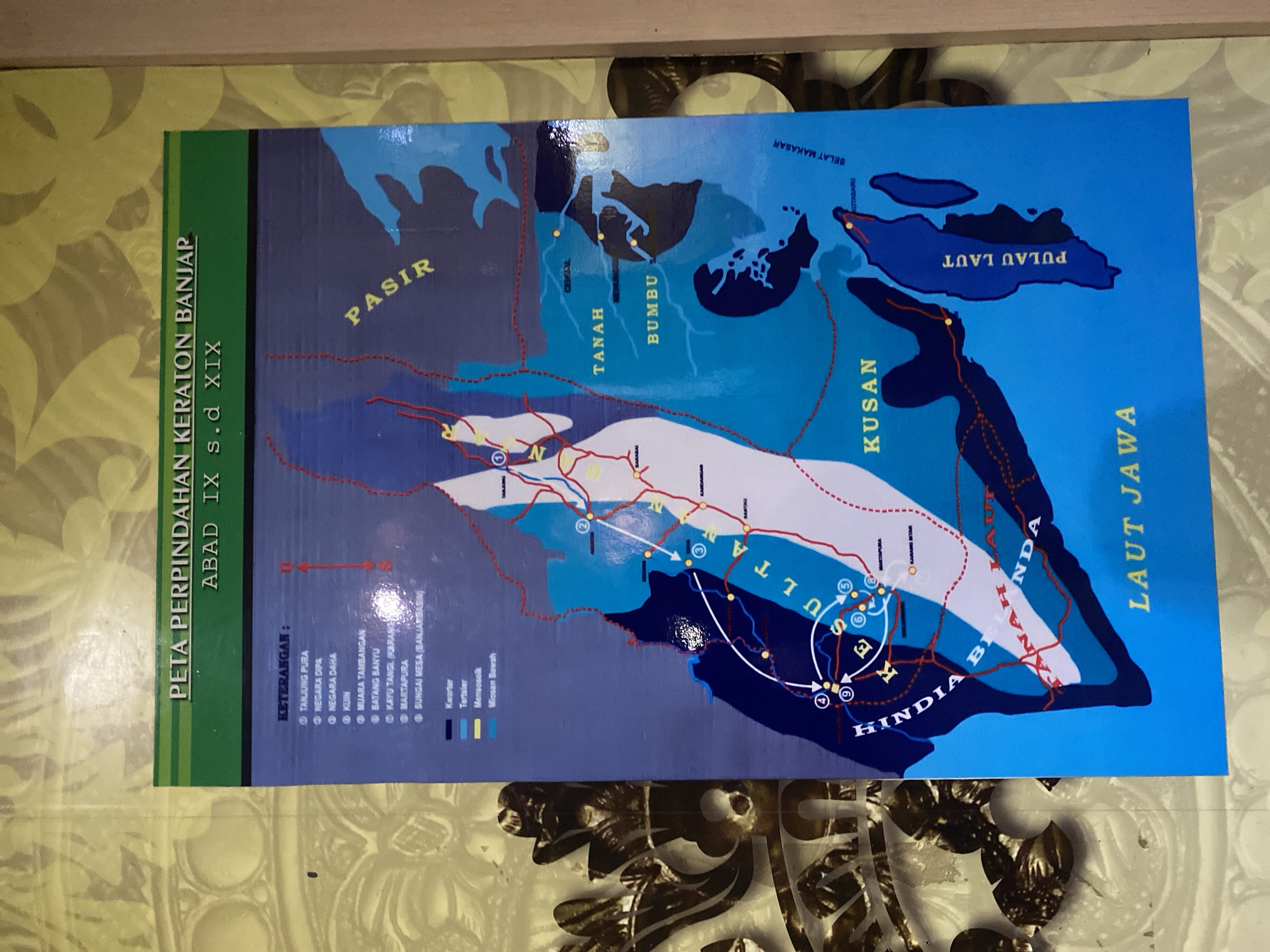
The image shows a map depicting the migration of the Banjar Sultanate's palace from the 9th to the 19th century. The map is titled "PETA PERPINDAHAN KERATON BANJAR ABAD IX s.d XIX" in Indonesian. A legend in the upper left corner lists various locations and geological periods, indicated by symbols. The map itself is a stylized representation of a geographical area with landmasses, bodies of water, and a network of red lines indicating migration routes. Several numbered circles on the map likely represent significant locations or periods in the sultanate's history. The map is displayed on a wall with a decorative, patterned surface. There are no people or specific actions depicted in the image; it is solely a map. The geographical context of Banjarbaru, Indonesia, is not explicitly shown or identified on this map, as it is a historical migration map of the Banjar Sultanate, which predates the modern administrative boundaries of Banjarbaru and encompasses a broader historical region.
No transactions found