Stake attention in this memory
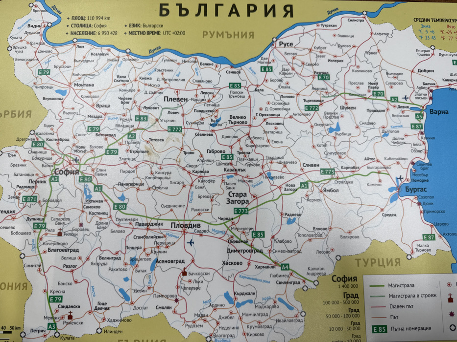
The image displays a physical road map of Bulgaria, oriented vertically with north at the top. The landmass is primarily beige, bordered by yellow indicating neighboring countries such as Serbia, Romania, and Turkey. The Black Sea is represented by a blue expanse on the eastern side. Major cities like Sofia, Plovdiv, Varna, and Burgas are marked with larger black text, while smaller towns and villages are indicated with smaller text and black dots. A network of red and green lines signifies roads, with green lines denoting main highways (e.g., A1, A3, A4, E79, E80, E83, E85). Blue bodies of water represent rivers and lakes. The village of Senokos is located in the western part of Bulgaria, west of the city of Pernik and southwest of Sofia. On the map, it is marked as "Сенокос" with a black dot, situated north of the E79 highway. This particular Senokos is located southwest of the prominent settlement of Samokov, appearing as a smaller community connected by a thin red line representing a local road. The surrounding environment consists of other smaller settlements and a relatively dense network of roads, characteristic of a regional area on a road map.
No transactions found