Stake attention in this memory
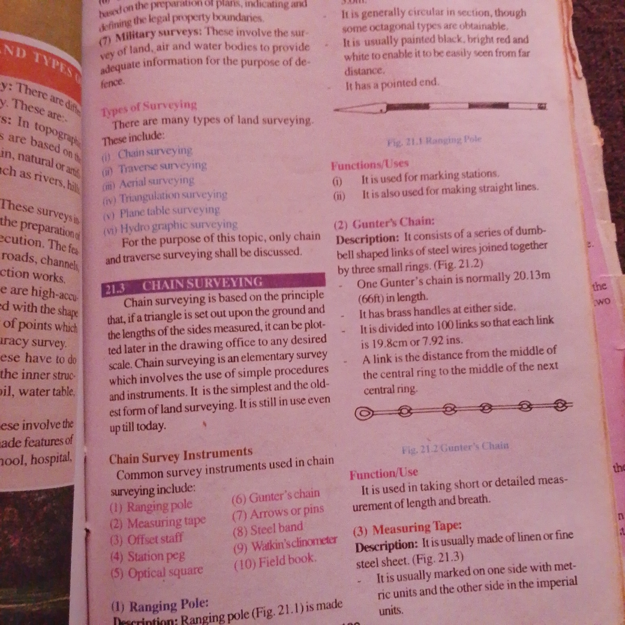
The image shows a close-up of two pages from a book, likely a textbook on surveying. The pages are filled with text and some illustrations. On the left page, the text discusses different types of surveys, including military surveys, and lists various types of surveying, such as chain surveying, traverse surveying, aerial surveying, triangulation surveying, plane table surveying, and hydrographic surveying. It then elaborates on chain surveying, defining it as a method based on setting out triangles on the ground and measuring the lengths of the sides. The section on "Chain Survey Instruments" lists common instruments used in chain surveying, including ranging pole, measuring tape, offset staff, station peg, optical square, Gunter's chain, arrows or pins, steel band, Watkin's clinometer, and field book. The right page continues with information related to surveying. It describes Gunter's Chain, including its construction and length (20.13m). It also mentions its use in marking stations and straight lines. A small illustration of what appears to be a ranging pole is visible at the top of this section. Further down, there is a section on "Measuring Tape" which describes its material and markings. Another illustration at the bottom depicts a chain, likely representing a Gunter's chain. The environment is a book, with pages showing printed text and line drawings. There are no people, objects, or actions in a physical environment beyond the book itself. The lighting suggests it is an indoor setting, possibly a library or study area, but no specific geographical location can be identified from the image content. There is no information in the image that relates to the city of Jalingo, Nigeria.
No transactions found