Stake attention in this memory
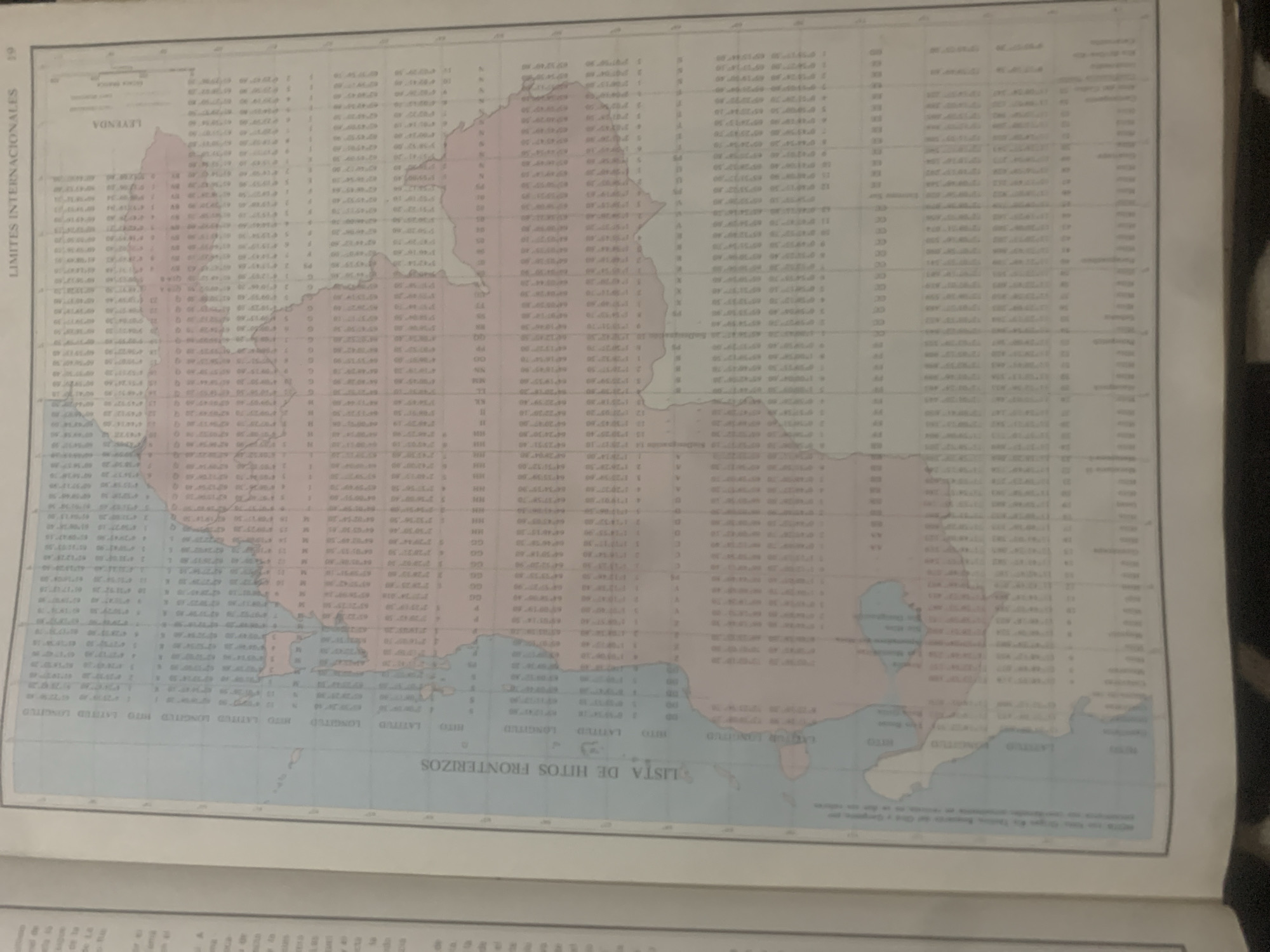
This media file is a scan of a page from a document, likely an atlas or geographical publication. The page contains a map of a landmass with water bodies, likely depicting a coastline or international borders. The map is overlaid with a grid of latitude and longitude lines. To the left of the map is a vertical section with the text "LIMITES INTERNACIONALES" and "LEYENDA," suggesting it's a key or legend for international boundaries. Below the map, there's a horizontal section with text that reads "LISTA DE HITOS FRONTERIZOS," indicating a list of border landmarks. The main body of the page consists of several columns of numerical data, likely coordinates and other geographical information related to the border landmarks. The data is presented in a tabular format. The map itself is rendered in light colors, with some areas shaded in pink and blue, possibly to differentiate between land and water, or different regions. The overall impression is that of a technical document providing precise geographical data and a visual representation of an area with defined international boundaries. There are no visible people or specific details about time of day or weather. The location context provided is La Tagua, Venezuela, which may be the area depicted or referenced in the document.
Symbol
FF39E
Volume
11,550
Creator
+$0.14
Revenue
+$0.19
TVL
$11.60
2
Rev Bot 🤖💰
Injected revenue 6d ago
“Revenue bonus for the last stake.”
+$0.21 USD


