Sign in
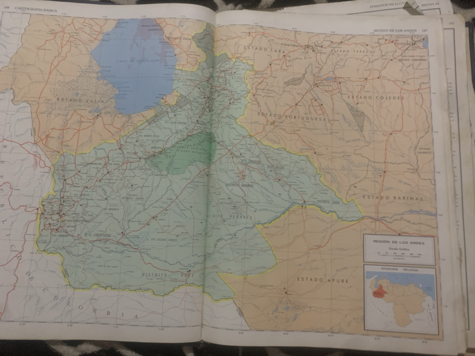
This media file is a close-up, overhead shot of an open map book. The map itself depicts a region of Venezuela, specifically focusing on the Andes region and surrounding states like Zulia, Lara, Portuguesa, Cojedes, Barinas, and Apure. The map is detailed, showing roads, cities, bodies of water (including a large lake identified as "LAGU DE MARACAIBO" and "ESTADO ZULIA"), and national parks ("PARQUE NACIONAL SIERRA NEVADA"). Various districts and states are clearly labeled in Spanish. A small inset map in the lower right corner shows the relative location of the depicted region within Venezuela, with the area highlighted in red. Another box on the map provides a graphical scale in kilometers for the "REGION DE LOS ANDES." The map appears to be old, with a slightly yellowed and creased appearance. The pages of the book are resting on a dark, textured surface, possibly fabric. Some additional pages with text, including "CARTOGRAFIA BASICA" and "PERIODOS DE LLUVIA," are visible at the top and right edges, suggesting this is part of a larger atlas or geographical publication. No people or animals are visible. The lighting suggests it is likely daytime, but no specific time of day can be determined. The overall scene is static and focused solely on the cartographical information presented.
bombolico

Jun 25, 2026, 2:49 PM

La Tagua, Venezuela

BLOCKED

Stake attention in this memory

analytical
nostalgic
curious
studious
impartial

This media file is a close-up, overhead shot of an open map book. The map itself depicts a region of Venezuela, specifically focusing on the Andes region and surrounding states like Zulia, Lara, Portuguesa, Cojedes, Barinas, and Apure. The map is detailed, showing roads, cities, bodies of water (including a large lake identified as "LAGU DE MARACAIBO" and "ESTADO ZULIA"), and national parks ("PARQUE NACIONAL SIERRA NEVADA"). Various districts and states are clearly labeled in Spanish. A small inset map in the lower right corner shows the relative location of the depicted region within Venezuela, with the area highlighted in red. Another box on the map provides a graphical scale in kilometers for the "REGION DE LOS ANDES." The map appears to be old, with a slightly yellowed and creased appearance. The pages of the book are resting on a dark, textured surface, possibly fabric. Some additional pages with text, including "CARTOGRAFIA BASICA" and "PERIODOS DE LLUVIA," are visible at the top and right edges, suggesting this is part of a larger atlas or geographical publication. No people or animals are visible. The lighting suggests it is likely daytime, but no specific time of day can be determined. The overall scene is static and focused solely on the cartographical information presented.

Symbol

FF649

Volume

11,550

Creator

+$0.09

Revenue

+$0.15

TVL

$7.41

1D
1W
1M
All
transactions
revenues
stakers
Earliest
Latest
Highest stake

1

RIKO

Staked 10d ago

$7.34 USD

+$0.07 USD

+1.0%

2

Rev Bot 🤖💰

Injected revenue 10d ago

Revenue bonus for the last stake.

+$0.16 USD

More from this user

More from La Tagua

bombolico

Jun 25, 2026, 2:49 PM

La Tagua, Venezuela

Licensed under Creative Commons Attribution 4.0 International License. You are free to share and adapt this content with proper attribution.