Stake attention in this memory
map
Ngoma District
Rwanda
geography
painted map
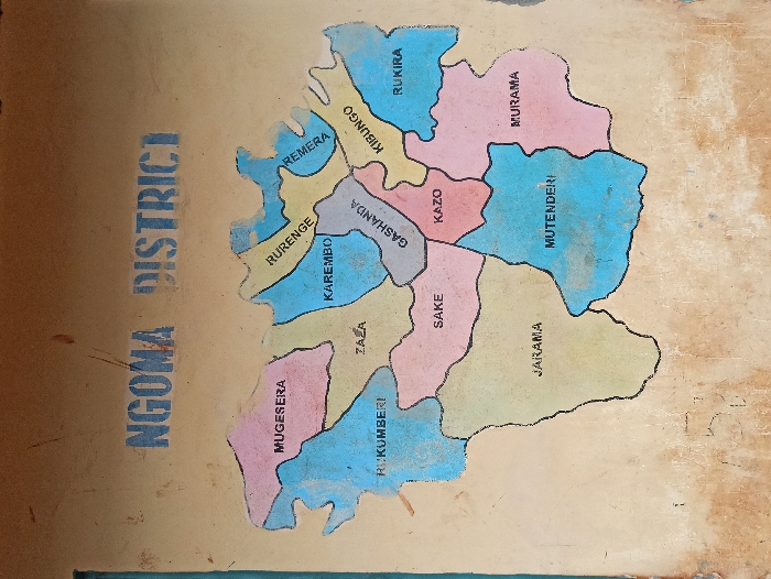
The image shows a hand-painted map of Ngoma District, likely displayed on a wall. The district is divided into several sectors or areas, each labeled with its name and colored differently. Visible sectors include Mugesera, Rukumberi, Zaza, Karembo, Rurenge, Remera, Kibungo, Gashanda, Kazo, Sake, Jarama, Mutenderi, Murama, and Rukira. The words "NGOMA DISTRICT" are clearly painted on the left side of the map.
transactions
revenues
stakers
Earliest
Latest
Highest stake
No transactions found