Stake attention in this memory
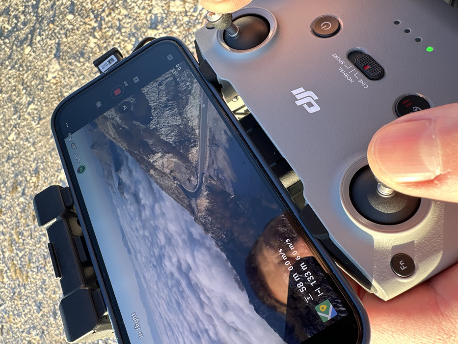
A close-up, high-angle shot shows an individual's hands operating a gray DJI drone remote controller with a smartphone attached atop it, positioned outdoors in Kuk, Montenegro. The remote controller features a prominent DJI logo, a mode switch set to "SPORT," a power button, an "Fn" button, and a green power indicator LED. The operator's right thumb is positioned on the right control stick. The smartphone screen displays a live aerial feed from a drone, depicting a panoramic mountainous landscape with a winding road visible on a mountain slope. A vast expanse of white, fluffy clouds covers the lower parts of the mountains, suggesting the drone is flying above the cloud layer under a clear blue sky. On-screen data overlays include "In flight" in the top left. The top right shows a battery icon at 94%, a strong signal indicator, a numerical value "2503," and a 4G/LTE icon. A red recording button and "EV 0.0" are also visible. At the bottom center of the screen, flight telemetry shows "I 58 m 0.0 m/s" (likely altitude and vertical speed) and "I-I 133 m 6.0 m/s" (likely horizontal distance and speed), alongside a Google Maps icon. A partial reflection of the operator's forehead and hair is visible on the lower left portion of the screen. The immediate ground surface visible beyond the hands is composed of light-colored gravel or small stones. The scene is illuminated by strong natural light, indicating a sunny day.
Symbol
FFBE4
Volume
53
Creator
+$0.09
Revenue
+$0.00
TVL
$0.05


