Babatpur, India
11 memories from Babatpur, India

A wide shot captures an Indigo Airlines airplane on a tarmac at night, likely at Babatpur Airport in India. The aircraft, predominantly white with blue accents, is illuminated by the runway lights and the glow of its own navigation lights and warning lights, which are predominantly red. The tail of the plane features the Indigo logo in blue and white lettering. A person in a high-visibility vest is visible near the front landing gear, possibly a ground crew member. The tarmac appears to be concrete, with visible cracks and markings. The background is dark, with the faint glow of distant lights suggesting the presence of a city or surrounding area. The sky is dark, indicating nighttime.
Babatpur
A pigeon stands near a potted plant in a hallway. The hallway has tiled flooring and large windows. There are other potted plants in the background, as well as people in the distance.
Babatpur
A detailed, colorful, and slightly aged mural depicts seven figures in orange and white robes, each holding a symbolic structure above their heads. They stand on individual platforms arranged in a semi-circle. Behind them, a backdrop of yellow and orange rays suggests a sunburst or divine light. Red flags and ornate chains with hanging bells are suspended from a decorative arch above the figures. To the right, a stylized representation of stacked buildings or towers is visible. The mural is mounted on a wall, with a portion of a white banner at the top displaying text that reads "For more information, visit: www.hnbr.res.in". In the foreground, a metal railing separates the mural from a row of potted green plants placed on a speckled gray surface. The scene appears to be indoors, possibly in a public space like an airport or a temple, given the religious iconography and the presence of potted plants for decoration. This mural is located in the city of Babatpur, India.
Babatpur
The image shows the interior of an airplane cabin, likely at Babatpur Airport in India, given the context. The perspective is from a passenger seated in an aisle seat, looking forward. The main subject is a person wearing a black face mask, sunglasses, and a black baseball cap. They are also wearing a red and black checkered flannel shirt over a white t-shirt. The passenger in front of the main subject, to the left, is partially visible. Other passengers are seated in rows along the aisle, with the airplane's ceiling and overhead compartments visible above. The lighting suggests daytime.
Babatpur
The video shows an airplane's wing with an orange fin and a white logo in the night sky. The airplane is in the process of taking off or landing, as evidenced by the runway lights visible below and the blur of motion. The surrounding environment appears to be an airport at night, with a dark sky and illuminated runway.
Babatpur
The video is a shaky, blurry, nighttime view from an airplane window. The focus is on the wingtip of the plane, which is orange with a white logo. The wingtip is silhouetted against a dark sky. In the background, there are lights on the ground, suggesting an airport tarmac. The lights are out of focus and appear as streaks of light. The video appears to be of the plane taxiing on the runway or preparing for takeoff.
Babatpur
The image captures a vibrant, ornately decorated statue of a bull, likely a representation of Nandi, the vahana of Lord Shiva, situated in Babatpur, India. The bull statue is adorned with intricate, colorful patterns featuring geometric shapes, floral motifs, and swirling designs in shades of blue, yellow, pink, green, and brown. Its horns are also decorated. The statue appears to be made of a solid material and is positioned outdoors, with lush green foliage visible in the background, suggesting a park or a religious site. To the left of the statue, a portion of a white, open umbrella is visible, supported by wooden ribs. In the middle ground, a structure with shelves painted in various colors, including orange, blue, and yellow, is partially visible. A vertical, reddish-orange pole stands prominently in the foreground, slightly obscuring the view of the statue and the colorful structure. The sky above is overcast and appears to be a pale gray. The overall scene suggests a cultural or religious landmark in Babatpur, India, characterized by its rich artistic decorations and serene outdoor setting.
Babatpur
An aerial view captures the landscape of Babatpur, India, from an airplane window. The image is dominated by the airplane wing, which occupies the upper left portion of the frame and features a distinctive blue stripe on its tip. Below, the rural scenery unfolds, characterized by a patchwork of agricultural fields, some appearing fallow with dry soil and others showing signs of cultivation with greener patches. Small clusters of houses, typical of Indian villages, are scattered throughout the landscape, nestled amongst trees. A hazy atmosphere suggests the image was taken during daytime with the sun high in the sky. The overall impression is one of a vast, cultivated rural expanse under a bright, partly cloudy sky.
Babatpur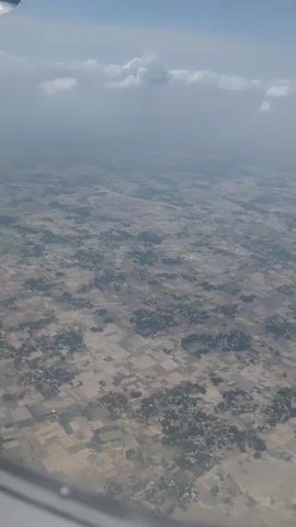
The video shows an aerial view of a landscape from an airplane window. The ground below is a patchwork of agricultural fields, some appearing fallow and others with crops. Scattered throughout the fields are clusters of buildings, suggesting villages or small settlements. The overall impression is of a rural area viewed from a high altitude. The sky above is partially obscured by clouds, and the light suggests it is daytime. The edge of the airplane's wing is visible in the lower left corner of the frame.
Babatpur
An aerial view from an airplane window shows a vast expanse of rural landscape with fields, scattered vegetation, and buildings. The fields are irregular in shape and appear to be harvested or fallow, with varying shades of brown and beige. Darker green patches indicate clusters of trees or densely vegetated areas. A road or highway runs diagonally through the scene, bordered by more settlements and fields. Small villages or hamlets are visible, characterized by clusters of buildings and trees. In the upper left quadrant, a portion of the airplane's wing is visible against a bright blue sky with scattered white clouds. The overall impression is of an agricultural region from a high vantage point. The specific location in Babatpur, India is characterized by this agricultural pattern, with the highway potentially being a major artery connecting to urban centers. The environment appears dry and possibly during a harvest or post-harvest season.
Babatpur
The photograph appears to have been taken in an airport terminal. A man with light skin, brown hair, and stubble lies sideways on chairs. He is wearing a grey hoodie over a black t-shirt with a gold design. The terminal has rows of unoccupied seating, and in the background, there's a sign that says "Popular Pharmacy". The location is likely Lal Bahadur Shastri International Airport, Babatpur, India.
Babatpur