Stake attention in this memory
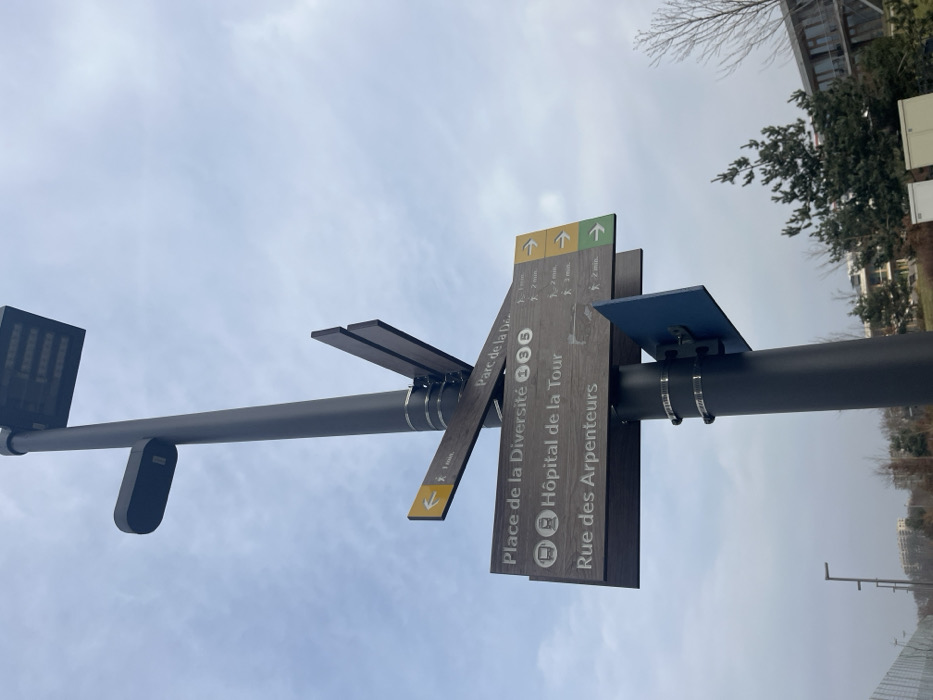
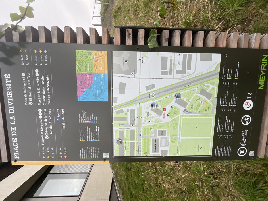
This image captures an outdoor information board or map, designed to guide visitors in Meyrin, Switzerland. The large, dark gray board is vertically oriented and set against a backdrop of green grass and a wooden fence or railing. Above the board, a bright, possibly overcast, sky is visible. The left side of the board is headed "PLACE DE LA DIVERSITÉ" and lists several destinations with estimated walking times, such as "Place de la Diversité" (<1 min, 2 min), "Hôpital de la Tour" (1 min), "Chemin de la Planche" (1 min), "Rue des Arpenteurs" (2 min), and "Parc de la Découverte" (<1 min). It also indicates "P Sports" and "Terrains de sport" (1 min). The central and largest part of the board features a detailed map with streets, buildings, and green areas, including an "ÉCOLE DES VERGERS". A red circle clearly marks "VOUS ÊTES ICI" (YOU ARE HERE) on the map. Several smaller, colored inset maps are in the upper left section. To the right of the main map, a legend uses icons to categorize various points of interest under headings like "ACTIVITÉS NATURES" and "ACTIVITÉS SPORTIVES ET DÉTENTES". The word "MEYRIN" is printed vertically in green along the right edge. Emergency services are indicated by the number "112" and an emergency phone icon, along with symbols for walking, cycling, and scooters. No people are visible in the image. The scene suggests a functional public space designed for navigation and information, likely within a park, campus, or urban area in Meyrin.
No transactions found