Stake attention in this memory
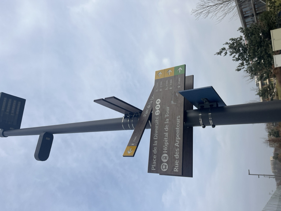
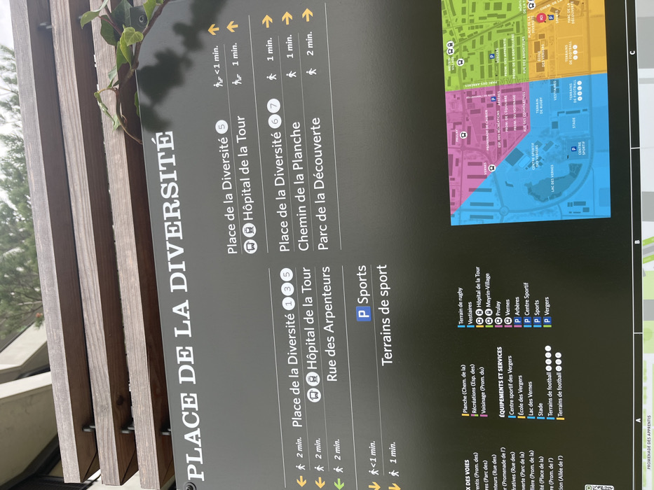
This media file captures an outdoor information sign, likely a wayfinding map, situated in Meyrin, Switzerland. The sign is dark gray with white and yellow text, oriented vertically with French text dominating the content. It appears to be daytime, with soft lighting and no direct sunlight, suggesting an overcast day. The left side of the sign, titled "PLACE DE LA DIVERSITÉ," provides walking directions and estimated times to various local destinations. These include "Place de la Diversité" (with multiple numbered entries like 1, 3, 5, 6, 7), "Hôpital de la Tour" (Hospital of the Tower), "Rue des Arpenteurs" (Arpenteurs Street), "Chemin de la Planche" (Planche Path), and "Parc de la Découverte" (Discovery Park). Each destination is accompanied by a pedestrian icon, a directional arrow (left, right, straight), and walking times ranging from "<1 min." to "2 min.". Some entries also feature a bus stop icon or a parking symbol "P Sports". The right side of the sign displays a colorful, schematic map of the surrounding area, divided into distinct zones by color (green, yellow, pink, blue). The map illustrates roads, buildings, green spaces, and a body of water labeled "LAC DES VERNES" (Lake of the Vergers). Below the map is a legend titled "ÉQUIPEMENTS ET SERVICES" (Equipment and Services), listing various facilities such as "Terrain de rugby" (Rugby field), "Vestiaires" (Changing rooms), "Stade" (Stadium), "Terrains de football" (Football fields), "Meyrin-Village," "Prulay," and "Vernes," each with a corresponding colored icon. The sign is mounted on a structure made of vertical wooden slats, partially obscured on the left by green ivy foliage. No people or activities are visible in the image, focusing solely on the informational display.
No transactions found