Stake attention in this memory
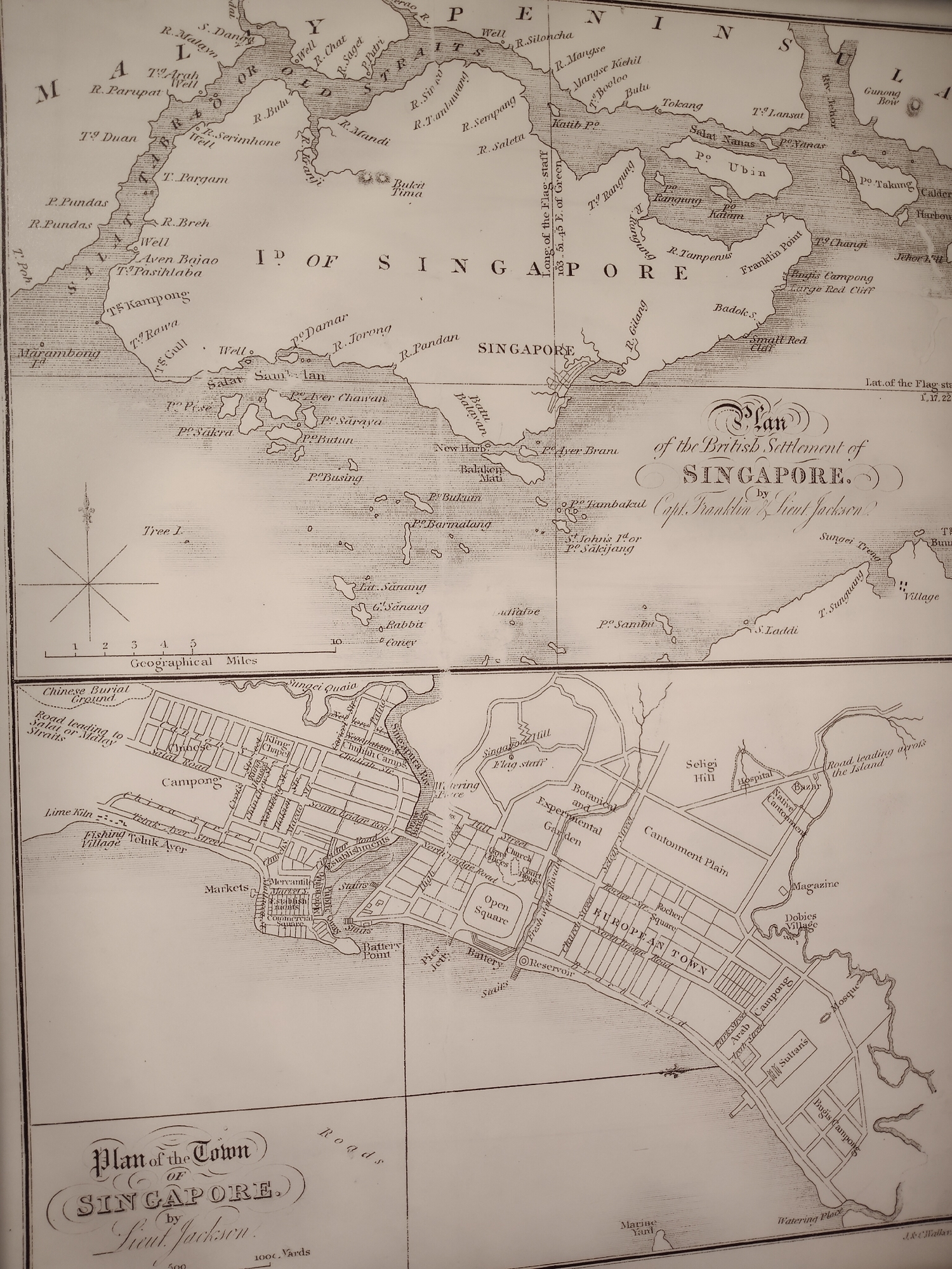
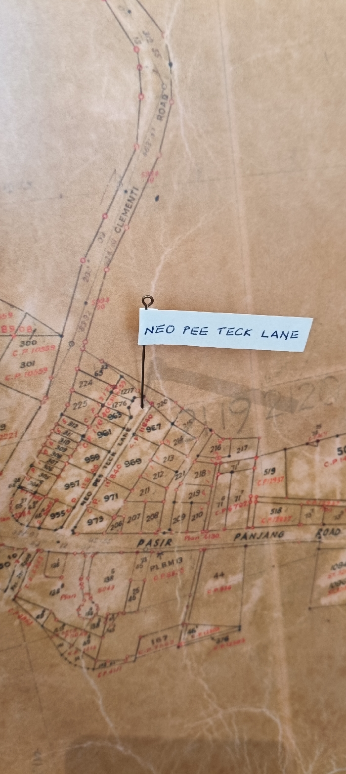
map
street names
plot numbers
land division
urban planning
The image displays a section of an old map featuring delineated land parcels and road networks. Prominent features include "NEO PEE TECK LANE", "PASIR PANJANG ROAD", and "CLEMENTI ROAD". Numeric notations indicate parcel numbers (e.g., 955, 957, 211), and other numbers may refer to survey data or land registration details. A sticky note attached with a pin highlights "NEO PEE TECK LANE" on the map. Red lines trace the parcel boundaries. The map's background reveals aged paper.
transactions
revenues
stakers
Earliest
Latest
Highest stake
No transactions found