Stake attention in this memory
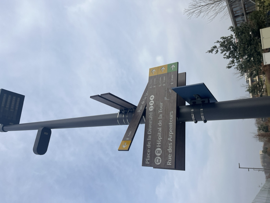
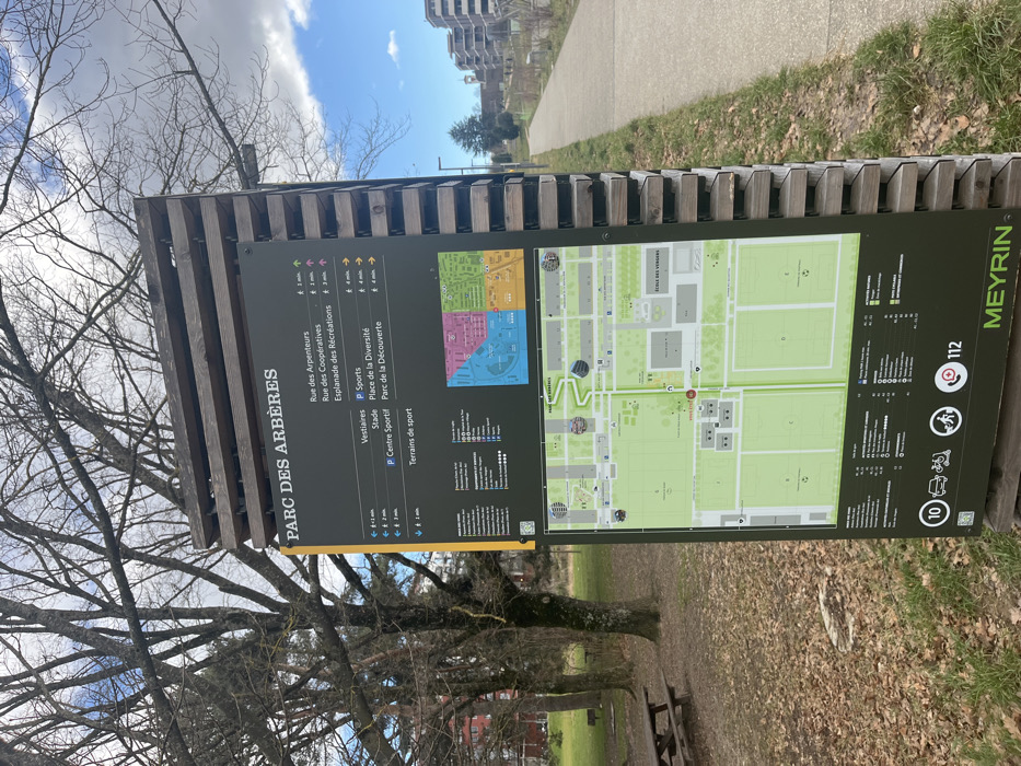
An outdoor shot captures a large, informational park sign in a slightly rotated, vertical orientation. The sign, titled "PARC DES ARBÈRES," is made of a dark panel mounted on a wooden support structure, positioned in what appears to be a public park or recreational area. The left side of the sign lists various destinations, including "Rue des Arpenteurs," "Rue des Coopératives," and facilities like "Vestiaires," "Stade," "P Centre Sportif," and "Terrains de sport," along with estimated walking times ranging from 2 to 4 minutes. The right side features a detailed map illustrating the layout of the park, showing green spaces, sports fields, pathways, and surrounding buildings. A smaller, color-coded overview map is visible in the upper right section of the main map. At the bottom right of the sign, "MEYRIN" is clearly displayed, along with an emergency number "112" and various icons suggesting services or regulations such as public transport (indicated by "10"), accessibility, and cycling. The setting appears to be late winter or early spring, as deciduous trees with bare branches dominate the background on the left. The ground is covered with fallen leaves and some grassy patches. A paved path or road is visible to the right of the sign, leading towards some modern-looking apartment buildings in the distance. The sky is partly cloudy but bright, indicating a daytime scene. A wooden picnic bench or table can be faintly seen in the lower right background, amidst the trees. No people are present in the image.
No transactions found