Stake attention in this memory
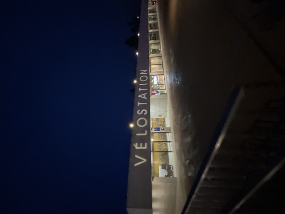
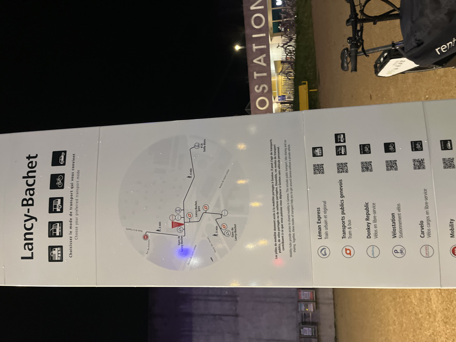
The image displays a large, vertical information panel, oriented horizontally in the captured photograph, illuminated at night. The panel is divided into several sections providing information about transportation options, likely for a mobility hub. On the left side of the panel, the title "Lancy-Bachet" is prominently displayed in a bold, dark sans-serif font. Below this, there's text in both French and English: "Choisissez le mode de transport qui vous convient / Choose your preferred transport mode." This text is accompanied by four small icons representing a car, a bicycle, a bus, and a train, each within a square frame. The central part of the left section features a circular, stylized map showing different routes and points of interest around "Gare de Lancy-Bachet." Key locations marked on the map include "Gare de Lancy-Bachet," "Lancy-Bachet P+R," and "Terre-Blanc," with estimated walking times like "3 min," "4 min," and "5 min" to various destinations. The map shows pathways and connections between these points. Moving to the right of the map, there is a block of text in French and English explaining the concept of mobility hubs: "Les pôles de mobilité donnent accès à la mobilité partagée à Genève. Il peut s'agir de transports publics, de vélos partagés ou de voitures partagées. Ensemble, ces modes de transport contribuent à ce que vous puissiez vous déplacer à Genève sans véhicule personnel. / Mobility hubs provide access to shared mobility in Geneva. This includes public transport, bike sharing and car sharing. Together, these modes of transport help you to get around Geneva without a private vehicle." The rightmost section of the panel lists various specific mobility services, each with an icon, name, and a short description, usually accompanied by a QR code: * **Léman Express:** "Train urbain et régional" (urban and regional train), with an icon depicting a stylized 'L' or train. * **Transports publics genevois:** "Tram & bus" (Geneva public transport for tram and bus), with an icon of a stylized 't' or 'a'. * **Donkey Republic:** "Vélos en libre-service" (self-service bicycles), with a donkey icon and a QR code below it. * **Vélostation:** "Stationnement vélos" (bicycle parking), with a 'P' (parking) icon and a QR code below it. * **Carvelo:** "Vélos cargos en libre-service" (self-service cargo bikes), with a bicycle icon and a QR code below it. * **Mobility:** This entry is partially visible, showing its icon and a QR code, but the descriptive text is cut off. The entire panel appears to be slightly reflective or speckled with small bright spots, possibly due to water droplets from rain or dew, which catches the light. In the background, against a dark night sky, a brightly lit sign with the text "OSTATION" is visible. Near this sign, bicycle racks are discernible, with several bicycles parked. To the far right, a dark-colored bicycle, possibly a rental or shared bike with "rent" visible on a bag attached to its handlebars, is parked, indicating the availability of such services at this location. The ground appears to be a paved or gravel surface. The overall scene suggests an urban or semi-urban environment at a transportation hub during nighttime, with artificial lighting providing visibility.
No transactions found