Stake attention in this memory
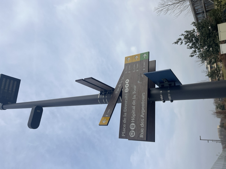
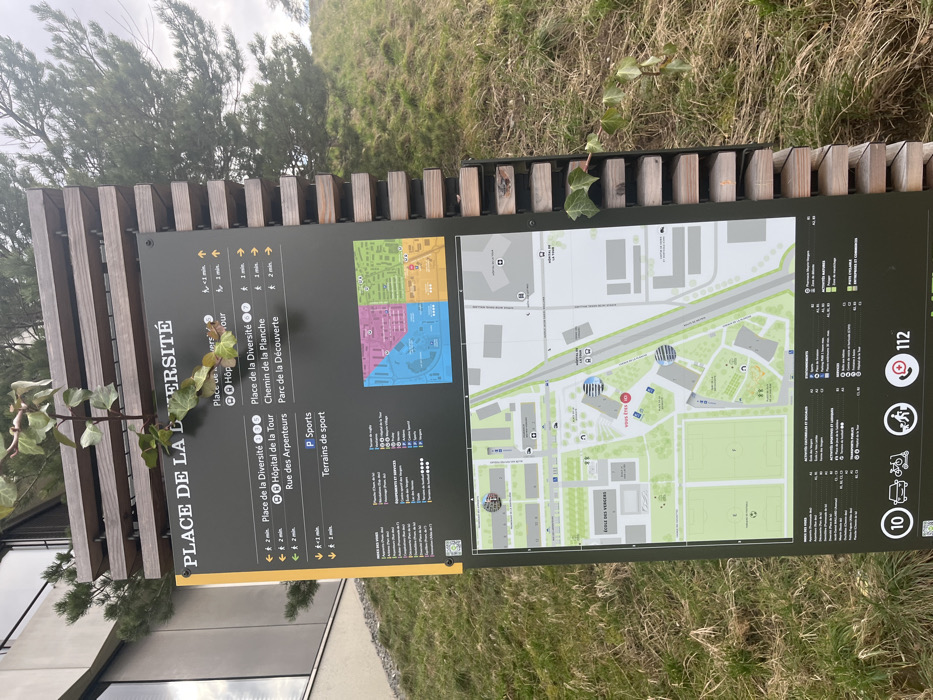
An outdoor informational sign or map board is prominently featured in a daytime shot, likely on a university campus or institutional area in Meyrin, Switzerland. The sign, mounted on a wooden slatted structure, displays a detailed map and directional information. Lush green grass and various bushes and trees form the background, with some ivy clinging to the sign's support structure and trailing onto the main board. The large dark grey sign, oriented horizontally in the frame, is titled "PLACE DE LA DIVERSITÉ" on its left side. It provides navigational details with upward-pointing arrows indicating destinations and estimated walking times, such as "Place de la Diversité" (2 min), "Hôpital de la Tour" (1 min), "Rue des Arpenteurs" (2 min), "Chemin de la Planche", and "Parc de la Découverte". It also points to "P Sports" and "Terrains de sport". The right side of the board showcases a detailed map with various buildings, roads, and green spaces, including "ECOLE DES VERGERS". Different sections of the map are color-coded, suggesting distinct zones or departments. Several icons are visible, including those for emergency services (a red cross and a phone symbol with "112"), accessibility, and sports activities. A small "10" is also present on the bottom right. The overall appearance suggests a functional public utility designed to assist visitors with orientation around a large complex.
No transactions found